


BETTENDORF W3P2, Scott County, Iowa
About
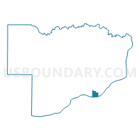
Outline

Summary
| Unique Area Identifier | 583418 |
| Name | BETTENDORF W3P2 |
| County | Scott County |
| State | Iowa |
| Area (square miles) | 1.61 |
| Land Area (square miles) | 1.30 |
| Water Area (square miles) | 0.32 |
| % of Land Area | 80.37 |
| % of Water Area | 19.63 |
| Latitude of the Internal Point | 41.52957250 |
| Longtitude of the Internal Point | -90.48626030 |
Maps


Graphs
Select a template below for downloading or customizing gragh for BETTENDORF W3P2, Scott County, Iowa


Neighbors
Neighoring Voting District (by Name) Neighboring Voting District on the Map
- BETTENDORF W1P1, Scott County, IA
- BETTENDORF W1P2, Scott County, IA
- BETTENDORF W3P1, Scott County, IA
- MOLINE 4-2 Voting District, Rock Island County, IL
- MOLINE 5-1 Voting District, Rock Island County, IL
- MOLINE 6-1 Voting District, Rock Island County, IL
- MOLINE 7-1 Voting District, Rock Island County, IL
- RIVERDALE Voting District, Scott County, IA
Top 10 Neighboring County Subdivision (by Population) Neighboring County Subdivision on the Map
- Pleasant Valley township, Scott County, IA (34,936)
- Moline township, Rock Island County, IL (23,529)
Top 10 Neighboring Place (by Population) Neighboring Place on the Map
Top 10 Neighboring Unified School District (by Population) Neighboring Unified School District on the Map
- Moline Unit School District 40, IL (48,693)
- Bettendorf Community School District, IA (21,800)
- Pleasant Valley Community School District, IA (20,868)
Top 10 Neighboring State Legislative District Lower Chamber (by Population) Neighboring State Legislative District Lower Chamber on the Map
- State House District 71, IL (104,867)
- State House District 72, IL (101,862)
- State House District 82, IA (31,123)
Top 10 Neighboring State Legislative District Upper Chamber (by Population) Neighboring State Legislative District Upper Chamber on the Map
Top 10 Neighboring 111th Congressional District (by Population) Neighboring 111th Congressional District on the Map
Top 10 Neighboring Census Tract (by Population) Neighboring Census Tract on the Map
- Census Tract 137.02, Scott County, IA (5,871)
- Census Tract 133, Scott County, IA (3,411)
- Census Tract 135, Scott County, IA (3,326)
- Census Tract 134, Scott County, IA (2,945)
- Census Tract 223, Rock Island County, IL (2,166)
- Census Tract 214, Rock Island County, IL (1,242)