


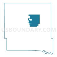
DOUGLAS PCT 1, Polk County, Iowa
About
Outline

Summary
| Unique Area Identifier | 583147 |
| Name | DOUGLAS PCT 1 |
| County | Polk County |
| State | Iowa |
| Area (square miles) | 29.35 |
| Land Area (square miles) | 29.34 |
| Water Area (square miles) | 0.01 |
| % of Land Area | 99.97 |
| % of Water Area | 0.03 |
| Latitude of the Internal Point | 41.73902120 |
| Longtitude of the Internal Point | -93.51253220 |
Maps


Graphs
Select a template below for downloading or customizing gragh for DOUGLAS PCT 1, Polk County, Iowa


Neighbors
Neighoring Voting District (by Name) Neighboring Voting District on the Map
- ANKENY PCT 1, Polk County, IA
- ANKENY PCT 2, Polk County, IA
- ANKENY PCT 8, Polk County, IA
- ANKENY PCT 9 W/CROCKER TWP PART, Polk County, IA
- BONDURANT PCT 1 W/DOUGLAS TWP & FRANKLIN TWP PARTS, Polk County, IA
- DELAWARE PCT 1, Polk County, IA
- ELKHART PCT 1, Polk County, IA
- FRANKLIN PCT 1, Polk County, IA
- WASHINGTON PCT 1, Polk County, IA
Top 10 Neighboring County Subdivision (by Population) Neighboring County Subdivision on the Map
- Clay township, Polk County, IA (16,022)
- Delaware township, Polk County, IA (8,317)
- Douglas township, Polk County, IA (5,542)
- Franklin township, Polk County, IA (3,760)
- Elkhart township, Polk County, IA (1,525)
- Washington township, Polk County, IA (420)
Top 10 Neighboring Place (by Population) Neighboring Place on the Map
Top 10 Neighboring Unified School District (by Population) Neighboring Unified School District on the Map
- Ankeny Community School District, IA (49,827)
- Saydel Community School District, IA (8,830)
- North Polk Community School District, IA (6,345)
- Bondurant-Farrar Community School District, IA (6,275)
Top 10 Neighboring State Legislative District Lower Chamber (by Population) Neighboring State Legislative District Lower Chamber on the Map
- State House District 69, IA (51,009)
- State House District 70, IA (41,393)
- State House District 42, IA (36,928)
Top 10 Neighboring State Legislative District Upper Chamber (by Population) Neighboring State Legislative District Upper Chamber on the Map
Top 10 Neighboring 111th Congressional District (by Population) Neighboring 111th Congressional District on the Map
Top 10 Neighboring Census Tract (by Population) Neighboring Census Tract on the Map
- Census Tract 106, Polk County, IA (8,321)
- Census Tract 101.02, Polk County, IA (5,915)
- Census Tract 102.09, Polk County, IA (5,494)
- Census Tract 101.01, Polk County, IA (4,247)
- Census Tract 102.12, Polk County, IA (4,035)
- Census Tract 102.11, Polk County, IA (3,791)