


JEFFERSON PCT 1, Polk County, Iowa
About
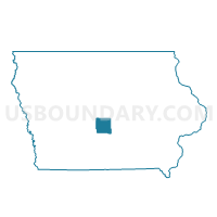
Outline

Summary
| Unique Area Identifier | 583128 |
| Name | JEFFERSON PCT 1 |
| County | Polk County |
| State | Iowa |
| Area (square miles) | 27.54 |
| Land Area (square miles) | 22.52 |
| Water Area (square miles) | 5.02 |
| % of Land Area | 81.77 |
| % of Water Area | 18.23 |
| Latitude of the Internal Point | 41.74189380 |
| Longtitude of the Internal Point | -93.75925670 |
Maps


Graphs
Select a template below for downloading or customizing gragh for JEFFERSON PCT 1, Polk County, Iowa


Neighbors
Neighoring Voting District (by Name) Neighboring Voting District on the Map
- CROCKER PCT 1, Polk County, IA
- DES MOINES TWP PART W/O WOODWARD PART Voting District, Dallas County, IA
- GRANGER IN DALLAS COUNTY Voting District, Dallas County, IA
- GRANGER IN POLK COUNTY Voting District, Polk County, IA
- GRANT TWP W/O GRANGER & GRIMES Voting District, Dallas County, IA
- GRIMES W/JEFFERSON TWP & WEBSTER TWP & URBANDALE PARTS Voting District, Polk County, IA
- JOHNSTON W/JEFFERSON TWP & WEBSTER TWP PARTS Voting District, Polk County, IA
- POLK CITY PCT 1, Polk County, IA
- SHELDAHL-UNION PCT 1, Polk County, IA
Top 10 Neighboring County Subdivision (by Population) Neighboring County Subdivision on the Map
- Webster township, Polk County, IA (54,365)
- Jefferson township, Polk County, IA (7,695)
- Grant township, Dallas County, IA (1,978)
- Des Moines township, Dallas County, IA (1,533)
- Saylorville Reservoir UT, Polk County, IA (79)
Top 10 Neighboring Place (by Population) Neighboring Place on the Map
Top 10 Neighboring Unified School District (by Population) Neighboring Unified School District on the Map
- Ankeny Community School District, IA (49,827)
- Johnston Community School District, IA (31,193)
- Dallas Center-Grimes Community School District, IA (9,527)
- North Polk Community School District, IA (6,345)
- Woodward-Granger Community School District, IA (5,052)
- Madrid Community School District, IA (3,536)
Top 10 Neighboring State Legislative District Lower Chamber (by Population) Neighboring State Legislative District Lower Chamber on the Map
Top 10 Neighboring State Legislative District Upper Chamber (by Population) Neighboring State Legislative District Upper Chamber on the Map
Top 10 Neighboring 111th Congressional District (by Population) Neighboring 111th Congressional District on the Map
Top 10 Neighboring Census Tract (by Population) Neighboring Census Tract on the Map
- Census Tract 102.03, Polk County, IA (20,422)
- Census Tract 113, Polk County, IA (13,584)
- Census Tract 117.01, Polk County, IA (8,671)
- Census Tract 114.04, Polk County, IA (6,078)
- Census Tract 115, Polk County, IA (5,237)
- Census Tract 501, Dallas County, IA (4,499)
Top 10 Neighboring 5-Digit ZIP Code Tabulation Area (by Population) Neighboring 5-Digit ZIP Code Tabulation Area on the Map
- 50023, IA (27,986)
- 50131, IA (17,499)
- 50111, IA (9,407)
- 50226, IA (4,724)
- 50156, IA (4,412)
- 50109, IA (2,762)
- 50276, IA (2,517)