


CLAY PCT 1, Polk County, Iowa
About
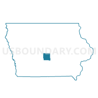
Outline

Summary
| Unique Area Identifier | 583116 |
| Name | CLAY PCT 1 |
| County | Polk County |
| State | Iowa |
| Area (square miles) | 11.80 |
| Land Area (square miles) | 11.80 |
| Water Area (square miles) | 0.00 |
| % of Land Area | 100.00 |
| % of Water Area | 0.00 |
| Latitude of the Internal Point | 41.63400150 |
| Longtitude of the Internal Point | -93.45389050 |
Maps


Graphs
Select a template below for downloading or customizing gragh for CLAY PCT 1, Polk County, Iowa


Neighbors
Neighoring Voting District (by Name) Neighboring Voting District on the Map
- ALTOONA W/CLAY TWP PART Voting District, Polk County, IA
- BONDURANT PCT 1 W/DOUGLAS TWP & FRANKLIN TWP PARTS, Polk County, IA
- DELAWARE PCT 2, Polk County, IA
- DELAWARE PCT 3, Polk County, IA
- DES MOINES PCT 29, Polk County, IA
- FOUR MILE PCT 1, Polk County, IA
- FRANKLIN PCT 1, Polk County, IA
- MITCHELLVILLE PCT 1, Polk County, IA
- PLEASANT HILL W/CLAY TWP & FOUR MILE TWP PARTS Voting District, Polk County, IA
- RUNNELLS PCT 1, Polk County, IA
Top 10 Neighboring County Subdivision (by Population) Neighboring County Subdivision on the Map
- Clay township, Polk County, IA (16,022)
- Four Mile township, Polk County, IA (9,250)
- Delaware township, Polk County, IA (8,317)
- Franklin township, Polk County, IA (3,760)
- Beaver township, Polk County, IA (3,032)
- Camp township, Polk County, IA (2,183)
Top 10 Neighboring Place (by Population) Neighboring Place on the Map
- Des Moines city, IA (203,433)
- Altoona city, IA (14,541)
- Pleasant Hill city, IA (8,785)
- Bondurant city, IA (3,860)
Top 10 Neighboring Unified School District (by Population) Neighboring Unified School District on the Map
- Southeast Polk Community School District, IA (31,979)
- Bondurant-Farrar Community School District, IA (6,275)
Top 10 Neighboring State Legislative District Lower Chamber (by Population) Neighboring State Legislative District Lower Chamber on the Map
- State House District 69, IA (51,009)
- State House District 67, IA (37,653)
- State House District 42, IA (36,928)
Top 10 Neighboring State Legislative District Upper Chamber (by Population) Neighboring State Legislative District Upper Chamber on the Map
- State Senate District 35, IA (92,402)
- State Senate District 34, IA (69,287)
- State Senate District 21, IA (65,772)
Top 10 Neighboring 111th Congressional District (by Population) Neighboring 111th Congressional District on the Map
Top 10 Neighboring Census Tract (by Population) Neighboring Census Tract on the Map
- Census Tract 106, Polk County, IA (8,321)
- Census Tract 107.06, Polk County, IA (5,984)
- Census Tract 101.02, Polk County, IA (5,915)
- Census Tract 107.02, Polk County, IA (5,701)
- Census Tract 107.03, Polk County, IA (4,533)
- Census Tract 107.05, Polk County, IA (4,500)
- Census Tract 108.04, Polk County, IA (4,177)