


WILLIAMSBURG Voting District, Iowa County, Iowa
About
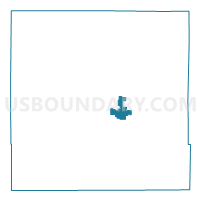
Outline

Summary
| Unique Area Identifier | 582374 |
| Name | WILLIAMSBURG Voting District |
| County | Iowa County |
| State | Iowa |
| Area (square miles) | 3.75 |
| Land Area (square miles) | 3.74 |
| Water Area (square miles) | 0.01 |
| % of Land Area | 99.78 |
| % of Water Area | 0.22 |
| Latitude of the Internal Point | 41.66889960 |
| Longtitude of the Internal Point | -92.01326050 |
Maps


Graphs
Select a template below for downloading or customizing gragh for WILLIAMSBURG Voting District, Iowa County, Iowa


Neighbors
Neighoring Voting District (by Name) Neighboring Voting District on the Map
- HILTON TWP W/O WILLIAMSBURG Voting District, Iowa County, IA
- TROY TWP W/O WILLIAMSBURG Voting District, Iowa County, IA