


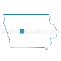
SCRANTON TWP Voting District, Greene County, Iowa
About
Outline

Summary
| Unique Area Identifier | 582175 |
| Name | SCRANTON TWP Voting District |
| County | Greene County |
| State | Iowa |
| Area (square miles) | 34.77 |
| Land Area (square miles) | 34.54 |
| Water Area (square miles) | 0.23 |
| % of Land Area | 99.35 |
| % of Water Area | 0.65 |
| Latitude of the Internal Point | 41.97874620 |
| Longtitude of the Internal Point | -94.58094620 |
Maps


Graphs
Select a template below for downloading or customizing gragh for SCRANTON TWP Voting District, Greene County, Iowa


Neighbors
Neighoring Voting District (by Name) Neighboring Voting District on the Map
- BRISTOL TWP Voting District, Greene County, IA
- GREENBRIER TWP Voting District, Greene County, IA
- JACKSON TWP Voting District, Greene County, IA
- KENDRICK TWP W/O RALSTON Voting District, Greene County, IA
- RALSTON IN CARROLL COUNTY Voting District, Carroll County, IA
- RALSTON IN GREENE COUNTY Voting District, Greene County, IA
- RICHLAND TWP Voting District, Carroll County, IA
- WILLOW TWP Voting District, Greene County, IA
Top 10 Neighboring County Subdivision (by Population) Neighboring County Subdivision on the Map
- Glidden township, Carroll County, IA (1,470)
- Scranton township, Greene County, IA (707)
- Jackson township, Greene County, IA (199)
- Bristol township, Greene County, IA (192)
- Kendrick township, Greene County, IA (192)
- Richland township, Carroll County, IA (175)
- Willow township, Greene County, IA (133)
- Greenbrier township, Greene County, IA (129)
Top 10 Neighboring Place (by Population) Neighboring Place on the Map
Top 10 Neighboring Unified School District (by Population) Neighboring Unified School District on the Map
- Jefferson-Scranton Community School District, IA (6,127)
- Coon Rapids-Bayard Community School District, IA (2,632)
- Glidden-Ralston Community School District, IA (1,883)