


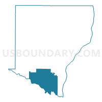
UNION TWP Voting District, Des Moines County, Iowa
About
Outline

Summary
| Unique Area Identifier | 581992 |
| Name | UNION TWP Voting District |
| County | Des Moines County |
| State | Iowa |
| Area (square miles) | 38.66 |
| Land Area (square miles) | 37.82 |
| Water Area (square miles) | 0.83 |
| % of Land Area | 97.84 |
| % of Water Area | 2.16 |
| Latitude of the Internal Point | 40.76886250 |
| Longtitude of the Internal Point | -91.21303970 |
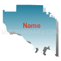
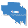
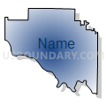
Maps


Graphs
Select a template below for downloading or customizing gragh for UNION TWP Voting District, Des Moines County, Iowa


Neighbors
Neighoring Voting District (by Name) Neighboring Voting District on the Map
- BURLINGTON PCT 10, Des Moines County, IA
- BURLINGTON PCT 9, Des Moines County, IA
- CONCORDIA TWP Voting District, Des Moines County, IA
- DANVILLE TWP W/DANVILLE Voting District, Des Moines County, IA
- DENMARK TWP Voting District, Lee County, IA
- FLINT RIVER TWP Voting District, Des Moines County, IA
- GREEN BAY TWP Voting District, Lee County, IA
- WEST BURLINGTON Voting District, Des Moines County, IA
Top 10 Neighboring County Subdivision (by Population) Neighboring County Subdivision on the Map
- Burlington city, Des Moines County, IA (25,663)
- West Burlington city, Des Moines County, IA (2,968)
- Flint River township, Des Moines County, IA (2,227)
- Denmark township, Lee County, IA (804)
- Union township, Des Moines County, IA (777)
- Danville township, Des Moines County, IA (759)
- Concordia township, Des Moines County, IA (714)
- Green Bay township, Lee County, IA (566)
Top 10 Neighboring Place (by Population) Neighboring Place on the Map
Top 10 Neighboring Unified School District (by Population) Neighboring Unified School District on the Map
- Burlington Community School District, IA (29,942)
- Fort Madison Community School District, IA (17,311)
- West Burlington Independent School District, IA (2,806)
- Danville Community School District, IA (2,680)
Top 10 Neighboring State Legislative District Lower Chamber (by Population) Neighboring State Legislative District Lower Chamber on the Map
- State House District 88, IA (27,882)
- State House District 87, IA (27,761)
- State House District 91, IA (27,706)
Top 10 Neighboring State Legislative District Upper Chamber (by Population) Neighboring State Legislative District Upper Chamber on the Map
Top 10 Neighboring 111th Congressional District (by Population) Neighboring 111th Congressional District on the Map
Top 10 Neighboring Census Tract (by Population) Neighboring Census Tract on the Map
- Census Tract 8, Des Moines County, IA (3,118)
- Census Tract 7, Des Moines County, IA (2,932)
- Census Tract 12, Des Moines County, IA (2,581)
- Census Tract 4903, Lee County, IA (2,258)