


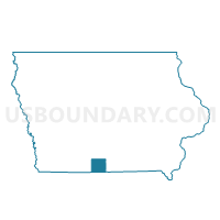
HAMILTON TWP Voting District, Decatur County, Iowa
About
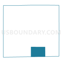
Outline

Summary
| Unique Area Identifier | 581954 |
| Name | HAMILTON TWP Voting District |
| County | Decatur County |
| State | Iowa |
| Area (square miles) | 25.33 |
| Land Area (square miles) | 25.20 |
| Water Area (square miles) | 0.13 |
| % of Land Area | 99.47 |
| % of Water Area | 0.53 |
| Latitude of the Internal Point | 40.60840540 |
| Longtitude of the Internal Point | -93.73685930 |
Maps

Graphs
Select a template below for downloading or customizing gragh for HAMILTON TWP Voting District, Decatur County, Iowa


Neighbors
Neighoring Voting District (by Name) Neighboring Voting District on the Map
- BURRELL TWP W/O DAVIS CITY Voting District, Decatur County, IA
- Cainsville Voting District, Harrison County, MO
- EDEN TWP Voting District, Decatur County, IA
- Lindley Voting District, Mercer County, MO
- MORGAN TWP Voting District, Decatur County, IA
- NEW BUDA TWP W/O DAVIS CITY Voting District, Decatur County, IA
- WOODLAND TWP Voting District, Decatur County, IA
Top 10 Neighboring County Subdivision (by Population) Neighboring County Subdivision on the Map
- Burrell township, Decatur County, IA (342)
- New Buda township, Decatur County, IA (291)
- Eden township, Decatur County, IA (282)
- Hamilton township, Decatur County, IA (158)
- Lindley township, Mercer County, MO (120)
- Woodland township, Decatur County, IA (110)
- Morgan township, Decatur County, IA (100)
- Clay township, Harrison County, MO (85)
Top 10 Neighboring Place (by Population) Neighboring Place on the Map
Top 10 Neighboring Unified School District (by Population) Neighboring Unified School District on the Map
- Central Decatur Community School District, IA (4,283)
- Princeton R-V School District, MO (2,633)
- North Mercer County R-III School District, MO (1,041)
- Cainsville R-I School District, MO (508)
Top 10 Neighboring State Legislative District Lower Chamber (by Population) Neighboring State Legislative District Lower Chamber on the Map
Top 10 Neighboring State Legislative District Upper Chamber (by Population) Neighboring State Legislative District Upper Chamber on the Map
Top 10 Neighboring 111th Congressional District (by Population) Neighboring 111th Congressional District on the Map
Top 10 Neighboring Census Tract (by Population) Neighboring Census Tract on the Map
- Census Tract 9501, Harrison County, MO (3,483)
- Census Tract 9601, Decatur County, IA (2,496)
- Census Tract 4701, Mercer County, MO (1,432)