


FRASER Voting District, Boone County, Iowa
About
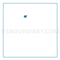
Outline

Summary
| Unique Area Identifier | 581521 |
| Name | FRASER Voting District |
| County | Boone County |
| State | Iowa |
| Area (square miles) | 0.88 |
| Land Area (square miles) | 0.83 |
| Water Area (square miles) | 0.05 |
| % of Land Area | 94.29 |
| % of Water Area | 5.71 |
| Latitude of the Internal Point | 42.12691490 |
| Longtitude of the Internal Point | -93.97467190 |
Maps


Graphs
Select a template below for downloading or customizing gragh for FRASER Voting District, Boone County, Iowa


Neighbors
Neighoring Voting District (by Name) Neighboring Voting District on the Map
- DODGE TWP W/O FRASER Voting District, Boone County, IA
- PILOT MOUND TWP W/O FRASER Voting District, Boone County, IA
- YELL TWP W/O FRASER & OGDEN Voting District, Boone County, IA
Top 10 Neighboring County Subdivision (by Population) Neighboring County Subdivision on the Map
- Yell township, Boone County, IA (2,218)
- Dodge township, Boone County, IA (536)
- Pilot Mound township, Boone County, IA (363)
Top 10 Neighboring Place (by Population) Neighboring Place on the Map
Top 10 Neighboring Unified School District (by Population) Neighboring Unified School District on the Map
- Ogden Community School District, IA (3,641)
- Southeast Webster-Grand Community School District, IA (3,439)