


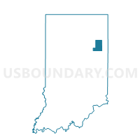
NOTTINGHAM, Wells County, Indiana
About
Outline

Summary
| Unique Area Identifier | 581268 |
| Name | NOTTINGHAM |
| County | Wells County |
| State | Indiana |
| Area (square miles) | 48.09 |
| Land Area (square miles) | 48.05 |
| Water Area (square miles) | 0.04 |
| % of Land Area | 99.92 |
| % of Water Area | 0.08 |
| Latitude of the Internal Point | 40.61476510 |
| Longtitude of the Internal Point | -85.13816580 |
Maps


Graphs
Select a template below for downloading or customizing gragh for NOTTINGHAM, Wells County, Indiana


Neighbors
Neighoring Voting District (by Name) Neighboring Voting District on the Map
- CHESTER, Wells County, IN
- HARRISON 02, Blackford County, IN
- HARRISON EAST, Wells County, IN
- HARRISON WEST, Wells County, IN
- HARTFORD, Adams County, IN
- JACKSON, Jay County, IN
- LIBERTY, Wells County, IN
- PENN, Jay County, IN
Top 10 Neighboring County Subdivision (by Population) Neighboring County Subdivision on the Map
- Harrison township, Wells County, IN (8,531)
- Harrison township, Blackford County, IN (2,640)
- Penn township, Jay County, IN (1,239)
- Liberty township, Wells County, IN (1,086)
- Nottingham township, Wells County, IN (1,062)
- Jackson township, Jay County, IN (965)
- Chester township, Wells County, IN (936)
- Hartford township, Adams County, IN (872)
Top 10 Neighboring Place (by Population) Neighboring Place on the Map
Top 10 Neighboring Unified School District (by Population) Neighboring Unified School District on the Map
- Jay School Corporation, IN (21,253)
- Blackford County Schools, IN (12,766)
- South Adams Schools, IN (10,536)
- Bluffton-Harrison Metropolitan School District, IN (8,531)
- Southern Wells Community Schools, IN (3,921)
Top 10 Neighboring State Legislative District Lower Chamber (by Population) Neighboring State Legislative District Lower Chamber on the Map
- State House District 82, IN (65,744)
- State House District 79, IN (62,178)
- State House District 33, IN (58,513)
- State House District 31, IN (55,677)
Top 10 Neighboring State Legislative District Upper Chamber (by Population) Neighboring State Legislative District Upper Chamber on the Map
Top 10 Neighboring 111th Congressional District (by Population) Neighboring 111th Congressional District on the Map
Top 10 Neighboring Census Tract (by Population) Neighboring Census Tract on the Map
- Census Tract 307, Adams County, IN (6,291)
- Census Tract 407, Wells County, IN (3,835)
- Census Tract 403, Wells County, IN (3,775)
- Census Tract 9751, Blackford County, IN (3,461)
- Census Tract 9627, Jay County, IN (3,347)
Top 10 Neighboring 5-Digit ZIP Code Tabulation Area (by Population) Neighboring 5-Digit ZIP Code Tabulation Area on the Map
- 46714, IN (14,645)
- 46740, IN (4,060)
- 47359, IN (3,143)
- 47326, IN (2,295)
- 47369, IN (1,343)
- 46781, IN (793)
- 46759, IN (652)