


PRAIRIE, Warren County, Indiana
About
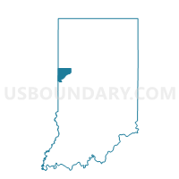
Outline

Summary
| Unique Area Identifier | 581102 |
| Name | PRAIRIE |
| County | Warren County |
| State | Indiana |
| Area (square miles) | 47.66 |
| Land Area (square miles) | 47.66 |
| Water Area (square miles) | 0.00 |
| % of Land Area | 100.00 |
| % of Water Area | 0.00 |
| Latitude of the Internal Point | 40.43295790 |
| Longtitude of the Internal Point | -87.45241530 |
Maps


Graphs
Select a template below for downloading or customizing gragh for PRAIRIE, Warren County, Indiana


Neighbors
Neighoring Voting District (by Name) Neighboring Voting District on the Map
- GRANT, Benton County, IN
- GRANT 5 Voting District, Vermilion County, IL
- HICKORY GROVE, Benton County, IN
- JORDAN, Warren County, IN
- LIBERTY, Warren County, IN
- PINE, Warren County, IN
Top 10 Neighboring County Subdivision (by Population) Neighboring County Subdivision on the Map
- Grant township, Vermilion County, IL (6,028)
- Grant township, Benton County, IN (1,056)
- Liberty township, Warren County, IN (896)
- Pine township, Warren County, IN (481)
- Hickory Grove township, Benton County, IN (409)
- Prairie township, Warren County, IN (257)
- Jordan township, Warren County, IN (247)
Top 10 Neighboring Unified School District (by Population) Neighboring Unified School District on the Map
- Benton Community School Corporation, IN (11,050)
- Warren County Metropolitan School District, IN (7,369)
- Hoopeston Area Community Unit School District 11, IL (7,293)
- Rossville-Alvin Community Unit School District 7, IL (2,390)
Top 10 Neighboring State Legislative District Lower Chamber (by Population) Neighboring State Legislative District Lower Chamber on the Map
- State House District 105, IL (109,839)
- State House District 15, IN (69,617)
- State House District 42, IN (58,863)
Top 10 Neighboring State Legislative District Upper Chamber (by Population) Neighboring State Legislative District Upper Chamber on the Map
- State Senate District 53, IL (226,526)
- State Senate District 6, IN (146,652)
- State Senate District 38, IN (121,551)
Top 10 Neighboring 111th Congressional District (by Population) Neighboring 111th Congressional District on the Map
- Congressional District 1, IN (705,600)
- Congressional District 8, IN (694,398)
- Congressional District 15, IL (681,580)
Top 10 Neighboring Census Tract (by Population) Neighboring Census Tract on the Map
- Census Tract 9510, Warren County, IN (4,746)
- Census Tract 9511, Warren County, IN (3,762)
- Census Tract 101, Vermilion County, IL (3,306)
- Census Tract 1003, Benton County, IN (2,326)
Top 10 Neighboring 5-Digit ZIP Code Tabulation Area (by Population) Neighboring 5-Digit ZIP Code Tabulation Area on the Map
- 60942, IL (6,181)
- 47993, IN (3,918)
- 47944, IN (3,623)
- 60963, IL (1,807)
- 47921, IN (1,078)
- 47917, IN (491)