


LINTON-A, Vigo County, Indiana
About
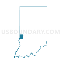
Outline

Summary
| Unique Area Identifier | 581027 |
| Name | LINTON-A |
| County | Vigo County |
| State | Indiana |
| Area (square miles) | 35.43 |
| Land Area (square miles) | 34.97 |
| Water Area (square miles) | 0.46 |
| % of Land Area | 98.71 |
| % of Water Area | 1.29 |
| Latitude of the Internal Point | 39.30647890 |
| Longtitude of the Internal Point | -87.41175300 |
Maps


Graphs
Select a template below for downloading or customizing gragh for LINTON-A, Vigo County, Indiana


Neighbors
Neighoring Voting District (by Name) Neighboring Voting District on the Map
- CURRY 1, Sullivan County, IN
- CURRY 3, Sullivan County, IN
- FAIRBANKS, Sullivan County, IN
- HONEY CREEK-B, Vigo County, IN
- HONEY CREEK-E, Vigo County, IN
- HONEY CREEK-I, Vigo County, IN
- JACKSON 1, Sullivan County, IN
- PIERSON- A, Vigo County, IN
- PRAIRIE CREEK-A, Vigo County, IN
- PRAIRIETON-A, Vigo County, IN
Top 10 Neighboring County Subdivision (by Population) Neighboring County Subdivision on the Map
- Honey Creek township, Vigo County, IN (17,179)
- Curry township, Sullivan County, IN (3,559)
- Jackson township, Sullivan County, IN (1,904)
- Linton township, Vigo County, IN (1,323)
- Prairieton township, Vigo County, IN (1,222)
- Pierson township, Vigo County, IN (1,210)
- Prairie Creek township, Vigo County, IN (1,195)
- Fairbanks township, Sullivan County, IN (733)
Top 10 Neighboring Place (by Population) Neighboring Place on the Map
Top 10 Neighboring Unified School District (by Population) Neighboring Unified School District on the Map
Top 10 Neighboring State Legislative District Lower Chamber (by Population) Neighboring State Legislative District Lower Chamber on the Map
Top 10 Neighboring State Legislative District Upper Chamber (by Population) Neighboring State Legislative District Upper Chamber on the Map
Top 10 Neighboring 111th Congressional District (by Population) Neighboring 111th Congressional District on the Map
Top 10 Neighboring Census Tract (by Population) Neighboring Census Tract on the Map
- Census Tract 112, Vigo County, IN (9,280)
- Census Tract 501, Sullivan County, IN (6,005)
- Census Tract 107.02, Vigo County, IN (5,693)
- Census Tract 110, Vigo County, IN (3,622)
- Census Tract 502, Sullivan County, IN (2,978)