


OLIVE TWP 03, St. Joseph County, Indiana
About
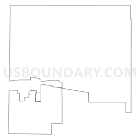
Outline
Summary
| Unique Area Identifier | 580416 |
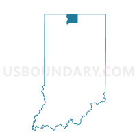
| Name | OLIVE TWP 03 |
| County | St. Joseph County |
| State | Indiana |
| Area (square miles) | 27.65 |
| Land Area (square miles) | 27.55 |
| Water Area (square miles) | 0.10 |
| % of Land Area | 99.64 |
| % of Water Area | 0.36 |
| Latitude of the Internal Point | 41.71769410 |
| Longtitude of the Internal Point | -86.47183610 |
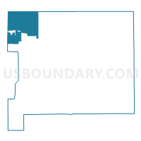
Maps

Graphs
Select a template below for downloading or customizing gragh for OLIVE TWP 03, St. Joseph County, Indiana


Neighbors
Neighoring Voting District (by Name) Neighboring Voting District on the Map
- Voting District 0210792000001, Berrien County, MI
- Voting District 0213132000001, Berrien County, MI
- HUDSON, LaPorte County, IN
- OLIVE TWP 01, St. Joseph County, IN
- OLIVE TWP 02, St. Joseph County, IN
- WARREN TWP 01, St. Joseph County, IN
- WARREN TWP 03, St. Joseph County, IN
- WARREN TWP 05, St. Joseph County, IN
- WILLS, LaPorte County, IN
Top 10 Neighboring County Subdivision (by Population) Neighboring County Subdivision on the Map
- Warren township, St. Joseph County, IN (7,605)
- Olive township, St. Joseph County, IN (4,704)
- Bertrand township, Berrien County, MI (2,657)
- Wills township, LaPorte County, IN (2,110)
- Hudson township, LaPorte County, IN (1,883)
- Galien township, Berrien County, MI (1,452)
Top 10 Neighboring Place (by Population) Neighboring Place on the Map
Top 10 Neighboring Unified School District (by Population) Neighboring Unified School District on the Map
- South Bend Community School Corporation, IN (160,103)
- New Prairie United School Corporation, IN (15,332)
- Galien Township School District, MI (2,588)
Top 10 Neighboring State Legislative District Lower Chamber (by Population) Neighboring State Legislative District Lower Chamber on the Map
- State House District 78, MI (86,900)
- State House District 8, IN (59,962)
- State House District 20, IN (59,794)
- State House District 7, IN (59,426)
Top 10 Neighboring State Legislative District Upper Chamber (by Population) Neighboring State Legislative District Upper Chamber on the Map
Top 10 Neighboring 111th Congressional District (by Population) Neighboring 111th Congressional District on the Map
Top 10 Neighboring Census Tract (by Population) Neighboring Census Tract on the Map
- Census Tract 109, St. Joseph County, IN (7,754)
- Census Tract 418, LaPorte County, IN (6,054)
- Census Tract 419, LaPorte County, IN (5,390)
- Census Tract 108, St. Joseph County, IN (4,660)
- Census Tract 417, LaPorte County, IN (3,395)
- Census Tract 203, Berrien County, MI (2,657)
- Census Tract 115, Berrien County, MI (1,452)