


BROWN II, Ripley County, Indiana
About
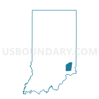
Outline

Summary
| Unique Area Identifier | 580296 |
| Name | BROWN II |
| County | Ripley County |
| State | Indiana |
| Area (square miles) | 25.72 |
| Land Area (square miles) | 25.70 |
| Water Area (square miles) | 0.02 |
| % of Land Area | 99.92 |
| % of Water Area | 0.08 |
| Latitude of the Internal Point | 38.96680920 |
| Longtitude of the Internal Point | -85.18708220 |
Maps


Graphs
Select a template below for downloading or customizing gragh for BROWN II, Ripley County, Indiana


Neighbors
Neighoring Voting District (by Name) Neighboring Voting District on the Map
- BROWN I, Ripley County, IN
- CAESAR CREEK 1, Dearborn County, IN
- CLAY 3, Dearborn County, IN
- JOHNSON III, Ripley County, IN
- PIKE 8, Ohio County, IN
- PLEASANT 02, Switzerland County, IN
- WASHINGTON I, Ripley County, IN
Top 10 Neighboring County Subdivision (by Population) Neighboring County Subdivision on the Map
- Johnson township, Ripley County, IN (3,685)
- Clay township, Dearborn County, IN (2,966)
- Washington township, Ripley County, IN (2,440)
- Brown township, Ripley County, IN (1,597)
- Pleasant township, Switzerland County, IN (1,521)
- Pike township, Ohio County, IN (527)
- Caesar Creek township, Dearborn County, IN (238)
Top 10 Neighboring Unified School District (by Population) Neighboring Unified School District on the Map
- South Dearborn Community School Corporation, IN (17,247)
- Switzerland County School Corporation, IN (10,613)
- South Ripley Community School Corporation, IN (7,691)
- Milan Community Schools, IN (6,213)
- Rising Sun-Ohio County Community Schools, IN (6,128)
Top 10 Neighboring State Legislative District Lower Chamber (by Population) Neighboring State Legislative District Lower Chamber on the Map
Top 10 Neighboring State Legislative District Upper Chamber (by Population) Neighboring State Legislative District Upper Chamber on the Map
Top 10 Neighboring 111th Congressional District (by Population) Neighboring 111th Congressional District on the Map
Top 10 Neighboring Census Tract (by Population) Neighboring Census Tract on the Map
- Census Tract 806, Dearborn County, IN (7,101)
- Census Tract 9689, Ripley County, IN (5,051)
- Census Tract 9658, Ohio County, IN (3,546)
- Census Tract 9687, Ripley County, IN (3,520)
- Census Tract 9658, Switzerland County, IN (3,411)
Top 10 Neighboring 5-Digit ZIP Code Tabulation Area (by Population) Neighboring 5-Digit ZIP Code Tabulation Area on the Map
- 47040, IN (5,480)
- 47042, IN (4,504)
- 47018, IN (4,275)
- 47011, IN (1,277)
- 47224, IN (636)
- 47017, IN (507)