


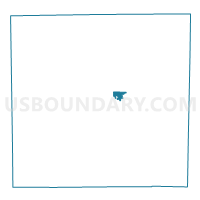
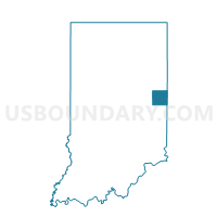
WINCHESTER 4, Randolph County, Indiana
About
Outline

Summary
| Unique Area Identifier | 580271 |
| Name | WINCHESTER 4 |
| County | Randolph County |
| State | Indiana |
| Area (square miles) | 0.82 |
| Land Area (square miles) | 0.82 |
| Water Area (square miles) | 0.00 |
| % of Land Area | 100.00 |
| % of Water Area | 0.00 |
| Latitude of the Internal Point | 40.16715700 |
| Longtitude of the Internal Point | -84.96917510 |
Maps

Graphs
Select a template below for downloading or customizing gragh for WINCHESTER 4, Randolph County, Indiana


Neighbors
Neighoring Voting District (by Name) Neighboring Voting District on the Map
- WHITE RIVER 2, Randolph County, IN
- WINCHESTER 1_2, Randolph County, IN
- WINCHESTER 3, Randolph County, IN