


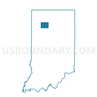
VAN BUREN, Pulaski County, Indiana
About
Outline

Summary
| Unique Area Identifier | 580221 |
| Name | VAN BUREN |
| County | Pulaski County |
| State | Indiana |
| Area (square miles) | 36.28 |
| Land Area (square miles) | 36.28 |
| Water Area (square miles) | 0.00 |
| % of Land Area | 100.00 |
| % of Water Area | 0.00 |
| Latitude of the Internal Point | 40.95367020 |
| Longtitude of the Internal Point | -86.52580870 |
Maps


Graphs
Select a template below for downloading or customizing gragh for VAN BUREN, Pulaski County, Indiana


Neighbors
Neighoring Voting District (by Name) Neighboring Voting District on the Map
- 39 BOONE, Cass County, IN
- CASS 1, White County, IN
- HARRISON, Pulaski County, IN
- INDIAN CREEK, Pulaski County, IN
- MONROE 03, Pulaski County, IN
- UNION, Fulton County, IN
- WAYNE, Fulton County, IN
Top 10 Neighboring County Subdivision (by Population) Neighboring County Subdivision on the Map
- Monroe township, Pulaski County, IN (4,019)
- Boone township, Cass County, IN (1,484)
- Union township, Fulton County, IN (1,397)
- Van Buren township, Pulaski County, IN (911)
- Indian Creek township, Pulaski County, IN (691)
- Harrison township, Pulaski County, IN (628)
- Cass township, White County, IN (585)
- Wayne township, Fulton County, IN (569)
Top 10 Neighboring Place (by Population) Neighboring Place on the Map
Top 10 Neighboring Unified School District (by Population) Neighboring Unified School District on the Map
- Eastern Pulaski Community School Corporation, IN (7,484)
- Pioneer Regional School Corporation, IN (5,196)
- Caston School Corporation, IN (4,626)
Top 10 Neighboring State Legislative District Lower Chamber (by Population) Neighboring State Legislative District Lower Chamber on the Map
Top 10 Neighboring State Legislative District Upper Chamber (by Population) Neighboring State Legislative District Upper Chamber on the Map
Top 10 Neighboring 111th Congressional District (by Population) Neighboring 111th Congressional District on the Map
Top 10 Neighboring Census Tract (by Population) Neighboring Census Tract on the Map
- Census Tract 9511, Cass County, IN (3,065)
- Census Tract 9589, Pulaski County, IN (2,792)
- Census Tract 9581, White County, IN (2,526)
- Census Tract 9510, Cass County, IN (2,458)
- Census Tract 9533, Fulton County, IN (2,008)