


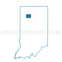
JEFFERSON, Pulaski County, Indiana
About
Outline

Summary
| Unique Area Identifier | 580213 |
| Name | JEFFERSON |
| County | Pulaski County |
| State | Indiana |
| Area (square miles) | 36.40 |
| Land Area (square miles) | 36.40 |
| Water Area (square miles) | 0.00 |
| % of Land Area | 100.00 |
| % of Water Area | 0.00 |
| Latitude of the Internal Point | 41.04136390 |
| Longtitude of the Internal Point | -86.75714450 |
Maps


Graphs
Select a template below for downloading or customizing gragh for JEFFERSON, Pulaski County, Indiana


Neighbors
Neighoring Voting District (by Name) Neighboring Voting District on the Map
- BEAVER, Pulaski County, IN
- CASS, Pulaski County, IN
- FRANKLIN, Pulaski County, IN
- INDIAN CREEK, Pulaski County, IN
- MONROE 03, Pulaski County, IN
- MONROE 04, Pulaski County, IN
- RICH GROVE, Pulaski County, IN
- SALEM, Pulaski County, IN
- WHITE POST, Pulaski County, IN
Top 10 Neighboring County Subdivision (by Population) Neighboring County Subdivision on the Map
- Monroe township, Pulaski County, IN (4,019)
- Salem township, Pulaski County, IN (1,399)
- White Post township, Pulaski County, IN (1,075)
- Rich Grove township, Pulaski County, IN (921)
- Cass township, Pulaski County, IN (878)
- Franklin township, Pulaski County, IN (715)
- Indian Creek township, Pulaski County, IN (691)
- Jefferson township, Pulaski County, IN (545)
- Beaver township, Pulaski County, IN (516)
Top 10 Neighboring Unified School District (by Population) Neighboring Unified School District on the Map
- North Judson-San Pierre School Corporation, IN (7,507)
- Eastern Pulaski Community School Corporation, IN (7,484)
- West Central School Corporation, IN (4,716)