


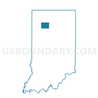
CASS, Pulaski County, Indiana
About
Outline

Summary
| Unique Area Identifier | 580211 |
| Name | CASS |
| County | Pulaski County |
| State | Indiana |
| Area (square miles) | 36.16 |
| Land Area (square miles) | 36.16 |
| Water Area (square miles) | 0.00 |
| % of Land Area | 100.00 |
| % of Water Area | 0.00 |
| Latitude of the Internal Point | 41.12876200 |
| Longtitude of the Internal Point | -86.87255830 |
Maps


Graphs
Select a template below for downloading or customizing gragh for CASS, Pulaski County, Indiana


Neighbors
Neighoring Voting District (by Name) Neighboring Voting District on the Map
- GILLIAM, Jasper County, IN
- JEFFERSON, Pulaski County, IN
- KANKAKEE, Jasper County, IN
- RAILROAD, Starke County, IN
- RICH GROVE, Pulaski County, IN
- WALKER EAST, Jasper County, IN
- WAYNE 01, Starke County, IN
- WHITE POST, Pulaski County, IN
Top 10 Neighboring County Subdivision (by Population) Neighboring County Subdivision on the Map
- Wayne township, Starke County, IN (4,541)
- Walker township, Jasper County, IN (3,663)
- Railroad township, Starke County, IN (1,226)
- White Post township, Pulaski County, IN (1,075)
- Kankakee township, Jasper County, IN (988)
- Rich Grove township, Pulaski County, IN (921)
- Cass township, Pulaski County, IN (878)
- Gillam township, Jasper County, IN (640)
- Jefferson township, Pulaski County, IN (545)
Top 10 Neighboring Place (by Population) Neighboring Place on the Map
Top 10 Neighboring Unified School District (by Population) Neighboring Unified School District on the Map
- Kankakee Valley School Corporation, IN (20,162)
- North Judson-San Pierre School Corporation, IN (7,507)
- West Central School Corporation, IN (4,716)
Top 10 Neighboring State Legislative District Lower Chamber (by Population) Neighboring State Legislative District Lower Chamber on the Map
Top 10 Neighboring State Legislative District Upper Chamber (by Population) Neighboring State Legislative District Upper Chamber on the Map
- State Senate District 5, IN (127,561)
- State Senate District 7, IN (124,746)
- State Senate District 18, IN (118,690)
Top 10 Neighboring 111th Congressional District (by Population) Neighboring 111th Congressional District on the Map
Top 10 Neighboring Census Tract (by Population) Neighboring Census Tract on the Map
- Census Tract 1008, Jasper County, IN (5,037)
- Census Tract 9542, Starke County, IN (3,980)
- Census Tract 9591, Pulaski County, IN (3,784)