


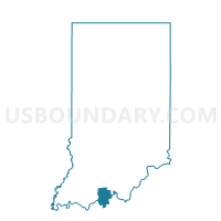
OIL, Perry County, Indiana
About
Outline

Summary
| Unique Area Identifier | 580020 |
| Name | OIL |
| County | Perry County |
| State | Indiana |
| Area (square miles) | 66.59 |
| Land Area (square miles) | 66.38 |
| Water Area (square miles) | 0.21 |
| % of Land Area | 99.68 |
| % of Water Area | 0.32 |
| Latitude of the Internal Point | 38.19138550 |
| Longtitude of the Internal Point | -86.56830880 |
Maps


Graphs
Select a template below for downloading or customizing gragh for OIL, Perry County, Indiana


Neighbors
Neighoring Voting District (by Name) Neighboring Voting District on the Map
- BOONE, Crawford County, IN
- CLARK 01, Perry County, IN
- CLARK 02, Perry County, IN
- JOHNSON, Crawford County, IN
- LEOPOLD, Perry County, IN
- OHIO 01, Crawford County, IN
- RONO, Perry County, IN
- UNION 02, Crawford County, IN
Top 10 Neighboring County Subdivision (by Population) Neighboring County Subdivision on the Map
- Oil township, Perry County, IN (2,546)
- Clark township, Perry County, IN (1,180)
- Leopold township, Perry County, IN (765)
- Union township, Crawford County, IN (761)
- Ohio township, Crawford County, IN (742)
- Union township, Perry County, IN (557)
- Johnson township, Crawford County, IN (484)
- Boone township, Crawford County, IN (175)
Top 10 Neighboring Unified School District (by Population) Neighboring Unified School District on the Map
- Crawford County Community School Corporation, IN (11,086)
- Perry Central Community School Corporation, IN (7,358)
Top 10 Neighboring State Legislative District Lower Chamber (by Population) Neighboring State Legislative District Lower Chamber on the Map
Top 10 Neighboring State Legislative District Upper Chamber (by Population) Neighboring State Legislative District Upper Chamber on the Map
Top 10 Neighboring 111th Congressional District (by Population) Neighboring 111th Congressional District on the Map
Top 10 Neighboring Census Tract (by Population) Neighboring Census Tract on the Map
- Census Tract 9522, Perry County, IN (5,345)
- Census Tract 9520, Crawford County, IN (4,031)
- Census Tract 9521, Crawford County, IN (2,877)
Top 10 Neighboring 5-Digit ZIP Code Tabulation Area (by Population) Neighboring 5-Digit ZIP Code Tabulation Area on the Map
- 47586, IN (10,932)
- 47118, IN (3,502)
- 47520, IN (3,267)
- 47513, IN (1,841)
- 47514, IN (1,559)
- 47137, IN (1,421)
- 47515, IN (965)
- 47116, IN (805)
- 47551, IN (649)
- 47576, IN (388)