


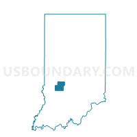
FRANKLIN, Owen County, Indiana
About
Outline

Summary
| Unique Area Identifier | 579985 |
| Name | FRANKLIN |
| County | Owen County |
| State | Indiana |
| Area (square miles) | 35.09 |
| Land Area (square miles) | 35.09 |
| Water Area (square miles) | 0.00 |
| % of Land Area | 99.99 |
| % of Water Area | 0.01 |
| Latitude of the Internal Point | 39.20802150 |
| Longtitude of the Internal Point | -86.84962850 |
Maps


Graphs
Select a template below for downloading or customizing gragh for FRANKLIN, Owen County, Indiana


Neighbors
Neighoring Voting District (by Name) Neighboring Voting District on the Map
- BEECH CREEK 01, Greene County, IN
- CLAY 02, Owen County, IN
- HIGHLAND, Greene County, IN
- JEFFERSON, Owen County, IN
- JEFFERSON 02, Greene County, IN
- LAFAYETTE, Owen County, IN
- WASHINGTON 03, Owen County, IN
- WASHINGTON 04, Owen County, IN
Top 10 Neighboring County Subdivision (by Population) Neighboring County Subdivision on the Map
- Washington township, Owen County, IN (6,164)
- Clay township, Owen County, IN (2,600)
- Beech Creek township, Greene County, IN (2,595)
- Jefferson township, Greene County, IN (2,094)
- Franklin township, Owen County, IN (1,269)
- Lafayette township, Owen County, IN (1,207)
- Jefferson township, Owen County, IN (1,129)
- Highland township, Greene County, IN (718)
Top 10 Neighboring Unified School District (by Population) Neighboring Unified School District on the Map
- Spencer-Owen Community Schools, IN (17,974)
- Eastern Greene County School District, IN (8,077)
- Bloomfield School District, IN (6,937)
- White River Valley School District, IN (5,783)
Top 10 Neighboring State Legislative District Lower Chamber (by Population) Neighboring State Legislative District Lower Chamber on the Map
- State House District 60, IN (70,940)
- State House District 46, IN (63,864)
- State House District 45, IN (59,062)
Top 10 Neighboring State Legislative District Upper Chamber (by Population) Neighboring State Legislative District Upper Chamber on the Map
Top 10 Neighboring 111th Congressional District (by Population) Neighboring 111th Congressional District on the Map
Top 10 Neighboring Census Tract (by Population) Neighboring Census Tract on the Map
- Census Tract 9557, Owen County, IN (5,117)
- Census Tract 9559, Owen County, IN (4,849)
- Census Tract 9547.02, Greene County, IN (3,844)
- Census Tract 9548, Greene County, IN (3,717)