


CASS 7, Ohio County, Indiana
About
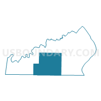
Outline

Summary
| Unique Area Identifier | 579946 |
| Name | CASS 7 |
| County | Ohio County |
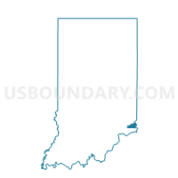
| State | Indiana |
| Area (square miles) | 18.54 |
| Land Area (square miles) | 18.54 |
| Water Area (square miles) | 0.00 |
| % of Land Area | 100.00 |
| % of Water Area | 0.00 |
| Latitude of the Internal Point | 38.92923420 |
| Longtitude of the Internal Point | -84.99263350 |
Maps

Graphs
Select a template below for downloading or customizing gragh for CASS 7, Ohio County, Indiana


Neighbors
Neighoring Voting District (by Name) Neighboring Voting District on the Map
- COTTON 01, Switzerland County, IN
- COTTON 02, Switzerland County, IN
- PIKE 8, Ohio County, IN
- RANDOLPH 6, Ohio County, IN
- UNION 9, Ohio County, IN
Top 10 Neighboring County Subdivision (by Population) Neighboring County Subdivision on the Map
- Randolph township, Ohio County, IN (4,383)
- Cotton township, Switzerland County, IN (2,040)
- Cass township, Ohio County, IN (714)
- Pike township, Ohio County, IN (527)
- Union township, Ohio County, IN (504)
Top 10 Neighboring Unified School District (by Population) Neighboring Unified School District on the Map
- Switzerland County School Corporation, IN (10,613)
- Rising Sun-Ohio County Community Schools, IN (6,128)