


PERRY, Lawrence County, Indiana
About
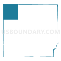
Outline

Summary
| Unique Area Identifier | 578967 |
| Name | PERRY |
| County | Lawrence County |
| State | Indiana |
| Area (square miles) | 35.68 |
| Land Area (square miles) | 35.64 |
| Water Area (square miles) | 0.04 |
| % of Land Area | 99.89 |
| % of Water Area | 0.11 |
| Latitude of the Internal Point | 38.96090670 |
| Longtitude of the Internal Point | -86.63243950 |
Maps


Graphs
Select a template below for downloading or customizing gragh for PERRY, Lawrence County, Indiana


Neighbors
Neighoring Voting District (by Name) Neighboring Voting District on the Map
- CENTER 02, Greene County, IN
- CLEAR CREEK 01, Monroe County, IN
- INDIAN CREEK, Monroe County, IN
- INDIAN CREEK NORTH, Lawrence County, IN
- JACKSON, Greene County, IN
- MARSHALL 01, Lawrence County, IN
- MARSHALL 03, Lawrence County, IN
- MITCHELTREE, Martin County, IN
Top 10 Neighboring County Subdivision (by Population) Neighboring County Subdivision on the Map
- Clear Creek township, Monroe County, IN (5,000)
- Marshall township, Lawrence County, IN (4,660)
- Center township, Greene County, IN (3,535)
- Indian Creek township, Lawrence County, IN (2,775)
- Perry township, Lawrence County, IN (2,259)
- Jackson township, Greene County, IN (1,947)
- Indian Creek township, Monroe County, IN (1,634)
- Mitcheltree township, Martin County, IN (624)
Top 10 Neighboring Unified School District (by Population) Neighboring Unified School District on the Map
- Monroe County Community School Corporation, IN (120,715)
- North Lawrence Community Schools, IN (34,125)
- Eastern Greene County School District, IN (8,077)
- Shoals Community School Corporation, IN (4,481)
Top 10 Neighboring State Legislative District Lower Chamber (by Population) Neighboring State Legislative District Lower Chamber on the Map
- State House District 60, IN (70,940)
- State House District 65, IN (64,454)
- State House District 62, IN (60,681)
Top 10 Neighboring State Legislative District Upper Chamber (by Population) Neighboring State Legislative District Upper Chamber on the Map
- State Senate District 39, IN (126,383)
- State Senate District 44, IN (123,667)
- State Senate District 48, IN (121,761)
Top 10 Neighboring 111th Congressional District (by Population) Neighboring 111th Congressional District on the Map
- Congressional District 4, IN (789,835)
- Congressional District 9, IN (729,076)
- Congressional District 8, IN (694,398)
Top 10 Neighboring Census Tract (by Population) Neighboring Census Tract on the Map
- Census Tract 9506, Lawrence County, IN (7,284)
- Census Tract 12, Monroe County, IN (5,898)
- Census Tract 9547.01, Greene County, IN (4,587)
- Census Tract 15.02, Monroe County, IN (2,724)
- Census Tract 9501, Martin County, IN (2,669)