


MARION 06, Lawrence County, Indiana
About
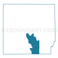
Outline

Summary
| Unique Area Identifier | 578963 |
| Name | MARION 06 |
| County | Lawrence County |
| State | Indiana |
| Area (square miles) | 28.95 |
| Land Area (square miles) | 28.68 |
| Water Area (square miles) | 0.27 |
| % of Land Area | 99.06 |
| % of Water Area | 0.94 |
| Latitude of the Internal Point | 38.75171390 |
| Longtitude of the Internal Point | -86.44281530 |
Maps


Graphs
Select a template below for downloading or customizing gragh for MARION 06, Lawrence County, Indiana


Neighbors
Neighoring Voting District (by Name) Neighboring Voting District on the Map
- BONO, Lawrence County, IN
- GUTHRIE, Lawrence County, IN
- MARION 01, Lawrence County, IN
- MARION 03, Lawrence County, IN
- MARION 04, Lawrence County, IN
- MARION 05A, Lawrence County, IN
- MARION 05B, Lawrence County, IN
- MARION 05C, Lawrence County, IN
- ORLEANS EAST, Orange County, IN
- ORLEANS NORTHWEST, Orange County, IN
- SHAWSWICK 15, Lawrence County, IN
Top 10 Neighboring County Subdivision (by Population) Neighboring County Subdivision on the Map
- Shawswick township, Lawrence County, IN (20,469)
- Marion township, Lawrence County, IN (9,449)
- Orleans township, Orange County, IN (3,555)
- Guthrie township, Lawrence County, IN (1,383)
- Bono township, Lawrence County, IN (833)
Top 10 Neighboring Place (by Population) Neighboring Place on the Map
Top 10 Neighboring Unified School District (by Population) Neighboring Unified School District on the Map
- North Lawrence Community Schools, IN (34,125)
- Mitchell Community Schools, IN (12,009)
- Orleans Community Schools, IN (4,762)
Top 10 Neighboring State Legislative District Lower Chamber (by Population) Neighboring State Legislative District Lower Chamber on the Map
Top 10 Neighboring State Legislative District Upper Chamber (by Population) Neighboring State Legislative District Upper Chamber on the Map
Top 10 Neighboring 111th Congressional District (by Population) Neighboring 111th Congressional District on the Map
Top 10 Neighboring Census Tract (by Population) Neighboring Census Tract on the Map
- Census Tract 9507, Lawrence County, IN (6,877)
- Census Tract 9512, Lawrence County, IN (6,425)
- Census Tract 9513, Lawrence County, IN (3,673)
- Census Tract 9513, Orange County, IN (3,517)