


SPICE VALLEY SOUTH, Lawrence County, Indiana
About
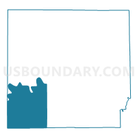
Outline

Summary
| Unique Area Identifier | 578951 |
| Name | SPICE VALLEY SOUTH |
| County | Lawrence County |
| State | Indiana |
| Area (square miles) | 53.38 |
| Land Area (square miles) | 52.53 |
| Water Area (square miles) | 0.85 |
| % of Land Area | 98.40 |
| % of Water Area | 1.60 |
| Latitude of the Internal Point | 38.74154480 |
| Longtitude of the Internal Point | -86.63188410 |
Maps


Graphs
Select a template below for downloading or customizing gragh for SPICE VALLEY SOUTH, Lawrence County, Indiana


Neighbors
Neighoring Voting District (by Name) Neighboring Voting District on the Map
- INDIAN CREEK SOUTH, Lawrence County, IN
- MARION 05A, Lawrence County, IN
- MARION 05B, Lawrence County, IN
- MARION 05C, Lawrence County, IN
- MITCHELTREE, Martin County, IN
- NORTH HALBERT, Martin County, IN
- NORTHWEST, Orange County, IN
- ORANGEVILLE, Orange County, IN
- SOUTH HALBERT, Martin County, IN
- SPICE VALLEY NORTH, Lawrence County, IN
Top 10 Neighboring County Subdivision (by Population) Neighboring County Subdivision on the Map
- Marion township, Lawrence County, IN (9,449)
- Indian Creek township, Lawrence County, IN (2,775)
- Spice Valley township, Lawrence County, IN (2,423)
- Halbert township, Martin County, IN (1,631)
- Orangeville township, Orange County, IN (658)
- Mitcheltree township, Martin County, IN (624)
- Northwest township, Orange County, IN (375)
Top 10 Neighboring Unified School District (by Population) Neighboring Unified School District on the Map
- North Lawrence Community Schools, IN (34,125)
- Mitchell Community Schools, IN (12,009)
- Springs Valley Community School Corporation, IN (5,760)
- Orleans Community Schools, IN (4,762)
- Shoals Community School Corporation, IN (4,481)
Top 10 Neighboring State Legislative District Lower Chamber (by Population) Neighboring State Legislative District Lower Chamber on the Map
Top 10 Neighboring State Legislative District Upper Chamber (by Population) Neighboring State Legislative District Upper Chamber on the Map
Top 10 Neighboring 111th Congressional District (by Population) Neighboring 111th Congressional District on the Map
- Congressional District 4, IN (789,835)
- Congressional District 9, IN (729,076)
- Congressional District 8, IN (694,398)
Top 10 Neighboring Census Tract (by Population) Neighboring Census Tract on the Map
- Census Tract 9507, Lawrence County, IN (6,877)
- Census Tract 9503, Martin County, IN (3,800)
- Census Tract 9514, Orange County, IN (3,156)
- Census Tract 9501, Martin County, IN (2,669)
Top 10 Neighboring 5-Digit ZIP Code Tabulation Area (by Population) Neighboring 5-Digit ZIP Code Tabulation Area on the Map
- 47421, IN (27,831)
- 47446, IN (9,990)
- 47452, IN (5,359)
- 47581, IN (3,883)
- 47469, IN (1,749)
- 47470, IN (1,735)
- 47437, IN (123)