


LIMA TOWNSHIP, LaGrange County, Indiana
About
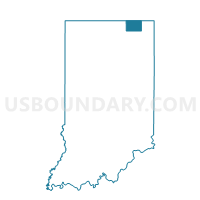
Outline

Summary
| Unique Area Identifier | 578262 |
| Name | LIMA TOWNSHIP |
| County | LaGrange County |
| State | Indiana |
| Area (square miles) | 25.10 |
| Land Area (square miles) | 24.45 |
| Water Area (square miles) | 0.65 |
| % of Land Area | 97.41 |
| % of Water Area | 2.59 |
| Latitude of the Internal Point | 41.73707380 |
| Longtitude of the Internal Point | -85.43602710 |
Maps


Graphs
Select a template below for downloading or customizing gragh for LIMA TOWNSHIP, LaGrange County, Indiana


Neighbors
Neighoring Voting District (by Name) Neighboring Voting District on the Map
- Voting District 1492754000001, St. Joseph County, MI
- Voting District 1497698000001, St. Joseph County, MI
- BLOOMFIELD I, LaGrange County, IN
- BLOOMFIELD IV, LaGrange County, IN
- CLAY TOWNSHIP, LaGrange County, IN
- GREENFIELD TOWNSHIP, LaGrange County, IN
- VAN BUREN TOWNSHIP, LaGrange County, IN
Top 10 Neighboring County Subdivision (by Population) Neighboring County Subdivision on the Map
- Bloomfield township, LaGrange County, IN (5,412)
- Van Buren township, LaGrange County, IN (3,439)
- Clay township, LaGrange County, IN (3,424)
- Lima township, LaGrange County, IN (2,507)
- Sturgis township, St. Joseph County, MI (2,261)
- Fawn River township, St. Joseph County, MI (1,477)
- Greenfield township, LaGrange County, IN (1,276)
Top 10 Neighboring Place (by Population) Neighboring Place on the Map
Top 10 Neighboring Unified School District (by Population) Neighboring Unified School District on the Map
- Westview School Corporation, IN (18,918)
- Sturgis Public Schools, MI (17,108)
- Lakeland School Corporation, IN (14,692)
Top 10 Neighboring State Legislative District Lower Chamber (by Population) Neighboring State Legislative District Lower Chamber on the Map
- State House District 59, MI (95,808)
- State House District 18, IN (68,681)
- State House District 52, IN (62,273)
Top 10 Neighboring State Legislative District Upper Chamber (by Population) Neighboring State Legislative District Upper Chamber on the Map
Top 10 Neighboring 111th Congressional District (by Population) Neighboring 111th Congressional District on the Map
Top 10 Neighboring Census Tract (by Population) Neighboring Census Tract on the Map
- Census Tract 9703, LaGrange County, IN (7,441)
- Census Tract 9701, LaGrange County, IN (6,324)
- Census Tract 415, St. Joseph County, MI (4,372)
- Census Tract 416, St. Joseph County, MI (3,729)