


HARRISON, Knox County, Indiana
About
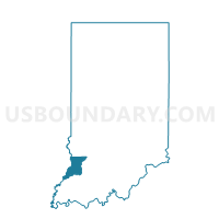
Outline

Summary
| Unique Area Identifier | 578158 |
| Name | HARRISON |
| County | Knox County |
| State | Indiana |
| Area (square miles) | 80.36 |
| Land Area (square miles) | 79.11 |
| Water Area (square miles) | 1.25 |
| % of Land Area | 98.44 |
| % of Water Area | 1.56 |
| Latitude of the Internal Point | 38.57730670 |
| Longtitude of the Internal Point | -87.35657250 |
Maps


Graphs
Select a template below for downloading or customizing gragh for HARRISON, Knox County, Indiana


Neighbors
Neighoring Voting District (by Name) Neighboring Voting District on the Map
- CLAY, Pike County, IN
- JOHNSON, Knox County, IN
- MADISON, Pike County, IN
- PALMYRA, Knox County, IN
- STEEN, Knox County, IN
- VEALE 1, Daviess County, IN
- WASHINGTON 3, Daviess County, IN
- WASHINGTON 3, Pike County, IN
Top 10 Neighboring County Subdivision (by Population) Neighboring County Subdivision on the Map
- Washington township, Daviess County, IN (15,534)
- Washington township, Pike County, IN (4,460)
- Harrison township, Knox County, IN (1,916)
- Palmyra township, Knox County, IN (1,466)
- Johnson township, Knox County, IN (1,382)
- Veale township, Daviess County, IN (1,095)
- Steen township, Knox County, IN (900)
- Madison township, Pike County, IN (382)
- Clay township, Pike County, IN (349)
Top 10 Neighboring Place (by Population) Neighboring Place on the Map
Top 10 Neighboring Unified School District (by Population) Neighboring Unified School District on the Map
- Washington Community School Corporation, IN (17,325)
- Pike County School Corporation, IN (12,845)
- South Knox School Corporation, IN (6,205)
Top 10 Neighboring State Legislative District Lower Chamber (by Population) Neighboring State Legislative District Lower Chamber on the Map
- State House District 63, IN (64,153)
- State House District 64, IN (60,833)
- State House District 45, IN (59,062)
Top 10 Neighboring State Legislative District Upper Chamber (by Population) Neighboring State Legislative District Upper Chamber on the Map
Top 10 Neighboring 111th Congressional District (by Population) Neighboring 111th Congressional District on the Map
Top 10 Neighboring Census Tract (by Population) Neighboring Census Tract on the Map
- Census Tract 9559, Knox County, IN (5,670)
- Census Tract 9546, Daviess County, IN (4,523)
- Census Tract 9558, Knox County, IN (3,453)
- Census Tract 9541, Pike County, IN (3,312)
- Census Tract 9540, Pike County, IN (2,989)
Top 10 Neighboring 5-Digit ZIP Code Tabulation Area (by Population) Neighboring 5-Digit ZIP Code Tabulation Area on the Map
- 47591, IN (26,770)
- 47501, IN (17,535)
- 47567, IN (6,021)
- 47557, IN (1,432)
- 47597, IN (1,023)
- 47524, IN (605)