


SPENCER SOUTH, Jennings County, Indiana
About
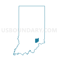
Outline

Summary
| Unique Area Identifier | 578036 |
| Name | SPENCER SOUTH |
| County | Jennings County |
| State | Indiana |
| Area (square miles) | 27.24 |
| Land Area (square miles) | 26.95 |
| Water Area (square miles) | 0.29 |
| % of Land Area | 98.93 |
| % of Water Area | 1.07 |
| Latitude of the Internal Point | 38.94492170 |
| Longtitude of the Internal Point | -85.74956040 |
Maps


Graphs
Select a template below for downloading or customizing gragh for SPENCER SOUTH, Jennings County, Indiana


Neighbors
Neighoring Voting District (by Name) Neighboring Voting District on the Map
- CENTER WEST, Jennings County, IN
- JACKSON 6, Jackson County, IN
- LOVETT, Jennings County, IN
- MARION, Jennings County, IN
- REDDING EAST, Jackson County, IN
- SPENCER NORTH, Jennings County, IN
- VERNON NORTH, Jackson County, IN
- VERNON WEST, Jennings County, IN
- WASHINGTON, Jackson County, IN
Top 10 Neighboring County Subdivision (by Population) Neighboring County Subdivision on the Map
- Jackson township, Jackson County, IN (20,042)
- Center township, Jennings County, IN (8,894)
- Redding township, Jackson County, IN (4,233)
- Vernon township, Jackson County, IN (3,419)
- Vernon township, Jennings County, IN (2,809)
- Spencer township, Jennings County, IN (2,326)
- Lovett township, Jennings County, IN (1,160)
- Washington township, Jackson County, IN (1,122)
- Marion township, Jennings County, IN (1,117)
Top 10 Neighboring Place (by Population) Neighboring Place on the Map
Top 10 Neighboring Unified School District (by Population) Neighboring Unified School District on the Map
- Jennings County Schools, IN (28,525)
- Seymour Community Schools, IN (27,072)
- Crothersville Community Schools, IN (3,419)
Top 10 Neighboring State Legislative District Lower Chamber (by Population) Neighboring State Legislative District Lower Chamber on the Map
- State House District 66, IN (64,746)
- State House District 65, IN (64,454)
- State House District 69, IN (62,245)
Top 10 Neighboring State Legislative District Upper Chamber (by Population) Neighboring State Legislative District Upper Chamber on the Map
- State Senate District 45, IN (138,973)
- State Senate District 43, IN (129,512)
- State Senate District 44, IN (123,667)
Top 10 Neighboring 111th Congressional District (by Population) Neighboring 111th Congressional District on the Map
Top 10 Neighboring Census Tract (by Population) Neighboring Census Tract on the Map
- Census Tract 9675, Jackson County, IN (7,782)
- Census Tract 9604, Jennings County, IN (6,778)
- Census Tract 9606, Jennings County, IN (5,044)
- Census Tract 9683, Jackson County, IN (3,419)