


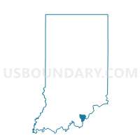
GEORGETOWN 1, Floyd County, Indiana
About
Outline

Summary
| Unique Area Identifier | 577125 |
| Name | GEORGETOWN 1 |
| County | Floyd County |
| State | Indiana |
| Area (square miles) | 4.41 |
| Land Area (square miles) | 4.38 |
| Water Area (square miles) | 0.02 |
| % of Land Area | 99.44 |
| % of Water Area | 0.56 |
| Latitude of the Internal Point | 38.31093080 |
| Longtitude of the Internal Point | -85.91527010 |
Maps


Graphs
Select a template below for downloading or customizing gragh for GEORGETOWN 1, Floyd County, Indiana


Neighbors
Neighoring Voting District (by Name) Neighboring Voting District on the Map
- GEORGETOWN 2, Floyd County, IN
- GEORGETOWN 3, Floyd County, IN
- GEORGETOWN 4, Floyd County, IN
- GREENVILLE 04, Floyd County, IN
- LAFAYETTE 03, Floyd County, IN
- LAFAYETTE 04, Floyd County, IN
Top 10 Neighboring County Subdivision (by Population) Neighboring County Subdivision on the Map
- Georgetown township, Floyd County, IN (9,632)
- Lafayette township, Floyd County, IN (7,449)
- Greenville township, Floyd County, IN (6,746)