


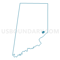
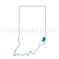
GREENDALE 1, Dearborn County, Indiana
About
Outline

Summary
| Unique Area Identifier | 576794 |
| Name | GREENDALE 1 |
| County | Dearborn County |
| State | Indiana |
| Area (square miles) | 0.77 |
| Land Area (square miles) | 0.75 |
| Water Area (square miles) | 0.01 |
| % of Land Area | 98.19 |
| % of Water Area | 1.81 |
| Latitude of the Internal Point | 39.10627390 |
| Longtitude of the Internal Point | -84.85835570 |
Maps

Graphs
Select a template below for downloading or customizing gragh for GREENDALE 1, Dearborn County, Indiana


Neighbors
Neighoring Voting District (by Name) Neighboring Voting District on the Map
- GREENDALE 2, Dearborn County, IN
- GREENDALE 3, Dearborn County, IN
- GREENDALE 5, Dearborn County, IN
- LAWRENCEBURG 1, Dearborn County, IN
- LAWRENCEBURG 3, Dearborn County, IN