


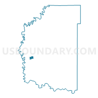
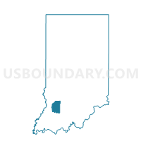
WASHINGTON 10, Daviess County, Indiana
About
Outline

Summary
| Unique Area Identifier | 576740 |
| Name | WASHINGTON 10 |
| County | Daviess County |
| State | Indiana |
| Area (square miles) | 0.65 |
| Land Area (square miles) | 0.65 |
| Water Area (square miles) | 0.00 |
| % of Land Area | 99.98 |
| % of Water Area | 0.02 |
| Latitude of the Internal Point | 38.65758180 |
| Longtitude of the Internal Point | -87.19715890 |
Maps

Graphs
Select a template below for downloading or customizing gragh for WASHINGTON 10, Daviess County, Indiana


Neighbors
Neighoring Voting District (by Name) Neighboring Voting District on the Map
- WASHINGTON 11, Daviess County, IN
- WASHINGTON 2, Daviess County, IN
- WASHINGTON 3, Daviess County, IN
- WASHINGTON 9, Daviess County, IN