


PATOKA 01, Crawford County, Indiana
About
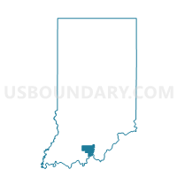
Outline

Summary
| Unique Area Identifier | 576724 |
| Name | PATOKA 01 |
| County | Crawford County |
| State | Indiana |
| Area (square miles) | 28.13 |
| Land Area (square miles) | 26.94 |
| Water Area (square miles) | 1.19 |
| % of Land Area | 95.77 |
| % of Water Area | 4.23 |
| Latitude of the Internal Point | 38.38327610 |
| Longtitude of the Internal Point | -86.58737780 |
Maps


Graphs
Select a template below for downloading or customizing gragh for PATOKA 01, Crawford County, Indiana


Neighbors
Neighoring Voting District (by Name) Neighboring Voting District on the Map
- GREENFIELD, Orange County, IN
- JACKSON, Orange County, IN
- JOHNSON, Crawford County, IN
- PATOKA 02, Crawford County, IN
- STERLING 01, Crawford County, IN
- STERLING 03, Crawford County, IN
- UNION 01, Crawford County, IN
Top 10 Neighboring County Subdivision (by Population) Neighboring County Subdivision on the Map
- Sterling township, Crawford County, IN (1,635)
- Patoka township, Crawford County, IN (1,579)
- Union township, Crawford County, IN (761)
- Greenfield township, Orange County, IN (730)
- Jackson township, Orange County, IN (686)
- Johnson township, Crawford County, IN (484)
Top 10 Neighboring Unified School District (by Population) Neighboring Unified School District on the Map
- Crawford County Community School Corporation, IN (11,086)
- Paoli Community School Corporation, IN (9,318)
- Springs Valley Community School Corporation, IN (5,760)