


JEFFERSONVILLE 42, Clark County, Indiana
About
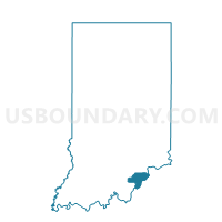
Outline

Summary
| Unique Area Identifier | 576579 |
| Name | JEFFERSONVILLE 42 |
| County | Clark County |
| State | Indiana |
| Area (square miles) | 2.81 |
| Land Area (square miles) | 2.74 |
| Water Area (square miles) | 0.07 |
| % of Land Area | 97.48 |
| % of Water Area | 2.52 |
| Latitude of the Internal Point | 38.33485340 |
| Longtitude of the Internal Point | -85.75996410 |
Maps


Graphs
Select a template below for downloading or customizing gragh for JEFFERSONVILLE 42, Clark County, Indiana


Neighbors
Neighoring Voting District (by Name) Neighboring Voting District on the Map
- JEFFERSONVILLE 16, Clark County, IN
- JEFFERSONVILLE 25, Clark County, IN
- JEFFERSONVILLE 27, Clark County, IN
- JEFFERSONVILLE 36, Clark County, IN
- JEFFERSONVILLE 40, Clark County, IN
- JEFFERSONVILLE 41, Clark County, IN
- NEW ALBANY 32, Floyd County, IN
- SILVER CREEK / CLARKVILLE 43, Clark County, IN
- SILVER CREEK 7, Clark County, IN
Top 10 Neighboring County Subdivision (by Population) Neighboring County Subdivision on the Map
- Jeffersonville township, Clark County, IN (59,062)
- New Albany township, Floyd County, IN (49,252)
- Silver Creek township, Clark County, IN (11,858)
Top 10 Neighboring Place (by Population) Neighboring Place on the Map
Top 10 Neighboring Unified School District (by Population) Neighboring Unified School District on the Map
- New Albany-Floyd County Consolidated Schools, IN (74,578)
- Greater Clark County Schools, IN (74,124)
- West Clark Community Schools, IN (26,966)
- Clarksville Community School Corporation, IN (9,142)
Top 10 Neighboring State Legislative District Lower Chamber (by Population) Neighboring State Legislative District Lower Chamber on the Map
- State House District 70, IN (72,273)
- State House District 71, IN (67,720)
- State House District 72, IN (63,511)
Top 10 Neighboring State Legislative District Upper Chamber (by Population) Neighboring State Legislative District Upper Chamber on the Map
Top 10 Neighboring 111th Congressional District (by Population) Neighboring 111th Congressional District on the Map
Top 10 Neighboring Census Tract (by Population) Neighboring Census Tract on the Map
- Census Tract 507.03, Clark County, IN (5,987)
- Census Tract 710.05, Floyd County, IN (5,519)
- Census Tract 505.03, Clark County, IN (5,447)
- Census Tract 506.05, Clark County, IN (5,354)
- Census Tract 505.04, Clark County, IN (3,069)
- Census Tract 504.03, Clark County, IN (2,913)