


ALBANY Voting District, Whiteside County, Illinois
About
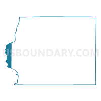
Outline

Summary
| Unique Area Identifier | 575185 |
| Name | ALBANY Voting District |
| County | Whiteside County |
| State | Illinois |
| Area (square miles) | 12.84 |
| Land Area (square miles) | 12.35 |
| Water Area (square miles) | 0.49 |
| % of Land Area | 96.18 |
| % of Water Area | 3.82 |
| Latitude of the Internal Point | 41.74929240 |
| Longtitude of the Internal Point | -90.22669830 |
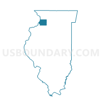
Maps

Graphs
Select a template below for downloading or customizing gragh for ALBANY Voting District, Whiteside County, Illinois


Neighbors
Neighoring Voting District (by Name) Neighboring Voting District on the Map
- CAMANCHE TWP PART Voting District, Clinton County, IA
- CLINTON W1P2 W/CAMANCHE TWP PART, Clinton County, IA
- COE Voting District, Rock Island County, IL
- CORDOVA Voting District, Rock Island County, IL
- ERIE 1 Voting District, Whiteside County, IL
- GARDEN PLAIN Voting District, Whiteside County, IL
- NEWTON Voting District, Whiteside County, IL
Top 10 Neighboring County Subdivision (by Population) Neighboring County Subdivision on the Map
- Clinton city, Clinton County, IA (26,885)
- Camanche township, Clinton County, IA (4,630)
- Erie township, Whiteside County, IL (2,006)
- Coe township, Rock Island County, IL (1,657)
- Albany township, Whiteside County, IL (1,076)
- Garden Plain township, Whiteside County, IL (1,072)
- Cordova township, Rock Island County, IL (896)
- Newton township, Whiteside County, IL (450)
Top 10 Neighboring Place (by Population) Neighboring Place on the Map
Top 10 Neighboring Unified School District (by Population) Neighboring Unified School District on the Map
- Riverdale Community Unit School District 100, IL (6,832)
- River Bend Community Unit District 2, IL (6,638)
- Camanche Community School District, IA (5,293)
- Erie Community Unit School District 1, IL (3,731)
Top 10 Neighboring State Legislative District Lower Chamber (by Population) Neighboring State Legislative District Lower Chamber on the Map
- State House District 71, IL (104,867)
- State House District 83, IA (30,728)
- State House District 26, IA (28,285)
Top 10 Neighboring State Legislative District Upper Chamber (by Population) Neighboring State Legislative District Upper Chamber on the Map
- State Senate District 36, IL (206,729)
- State Senate District 42, IA (62,375)
- State Senate District 13, IA (57,521)
Top 10 Neighboring 111th Congressional District (by Population) Neighboring 111th Congressional District on the Map
- Congressional District 16, IL (718,791)
- Congressional District 17, IL (634,792)
- Congressional District 1, IA (596,443)
Top 10 Neighboring Census Tract (by Population) Neighboring Census Tract on the Map
- Census Tract 201, Rock Island County, IL (7,127)
- Census Tract 8, Clinton County, IA (5,264)
- Census Tract 6, Whiteside County, IL (4,285)
- Census Tract 4, Whiteside County, IL (3,293)
- Census Tract 2, Clinton County, IA (2,100)
Top 10 Neighboring 5-Digit ZIP Code Tabulation Area (by Population) Neighboring 5-Digit ZIP Code Tabulation Area on the Map
- 52732, IA (28,293)
- 52730, IA (4,950)
- 61250, IL (2,737)
- 61230, IL (1,232)
- 61257, IL (1,210)
- 61242, IL (1,145)