


BURLINGTON 1 Voting District, Kane County, Illinois
About
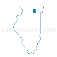
Outline

Summary
| Unique Area Identifier | 571414 |
| Name | BURLINGTON 1 Voting District |
| County | Kane County |
| State | Illinois |
| Area (square miles) | 33.78 |
| Land Area (square miles) | 33.78 |
| Water Area (square miles) | 0.00 |
| % of Land Area | 100.00 |
| % of Water Area | 0.00 |
| Latitude of the Internal Point | 42.02426310 |
| Longtitude of the Internal Point | -88.54550390 |
Maps


Graphs
Select a template below for downloading or customizing gragh for BURLINGTON 1 Voting District, Kane County, Illinois


Neighbors
Neighoring Voting District (by Name) Neighboring Voting District on the Map
- CAMPTON 4 Voting District, Kane County, IL
- CORTLAND 8 Voting District, DeKalb County, IL
- GENOA 3 Voting District, DeKalb County, IL
- HAMPSHIRE 1 Voting District, Kane County, IL
- HAMPSHIRE 3 Voting District, Kane County, IL
- PLATO 3 Voting District, Kane County, IL
- SYCAMORE 11 Voting District, DeKalb County, IL
- SYCAMORE 9 Voting District, DeKalb County, IL
- VIRGIL 2 Voting District, Kane County, IL
Top 10 Neighboring County Subdivision (by Population) Neighboring County Subdivision on the Map
- Campton township, Kane County, IL (17,174)
- Sycamore township, DeKalb County, IL (14,425)
- Cortland township, DeKalb County, IL (10,968)
- Hampshire township, Kane County, IL (7,569)
- Plato township, Kane County, IL (6,166)
- Genoa township, DeKalb County, IL (5,704)
- Virgil township, Kane County, IL (1,937)
- Burlington township, Kane County, IL (1,921)
Top 10 Neighboring Place (by Population) Neighboring Place on the Map
Top 10 Neighboring Unified School District (by Population) Neighboring Unified School District on the Map
- Community Unit School District 300, IL (110,689)
- Sycamore Community Unit School District 427, IL (21,667)
- Central Community Unit School District 301, IL (17,995)
- Genoa-Kingston Community Unit School District 424, IL (9,221)
Top 10 Neighboring State Legislative District Lower Chamber (by Population) Neighboring State Legislative District Lower Chamber on the Map
- State House District 50, IL (178,899)
- State House District 49, IL (154,080)
- State House District 69, IL (123,633)
- State House District 70, IL (121,976)
Top 10 Neighboring State Legislative District Upper Chamber (by Population) Neighboring State Legislative District Upper Chamber on the Map
Top 10 Neighboring 111th Congressional District (by Population) Neighboring 111th Congressional District on the Map
Top 10 Neighboring Census Tract (by Population) Neighboring Census Tract on the Map
- Census Tract 8507.02, Kane County, IL (13,599)
- Census Tract 4, DeKalb County, IL (8,622)
- Census Tract 1, DeKalb County, IL (6,712)
- Census Tract 8524.03, Kane County, IL (5,358)
- Census Tract 8507.03, Kane County, IL (2,278)