


SIMPSON Voting District, Johnson County, Illinois
About
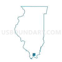
Outline

Summary
| Unique Area Identifier | 571399 |
| Name | SIMPSON Voting District |
| County | Johnson County |
| State | Illinois |
| Area (square miles) | 36.64 |
| Land Area (square miles) | 36.39 |
| Water Area (square miles) | 0.25 |
| % of Land Area | 99.32 |
| % of Water Area | 0.68 |
| Latitude of the Internal Point | 37.46876310 |
| Longtitude of the Internal Point | -88.76068900 |
Maps


Graphs
Select a template below for downloading or customizing gragh for SIMPSON Voting District, Johnson County, Illinois


Neighbors
Neighoring Voting District (by Name) Neighboring Voting District on the Map
- BLOOMFIELD Voting District, Johnson County, IL
- EDDYVILLE 6 Voting District, Pope County, IL
- GRANTSBURG 1 Voting District, Johnson County, IL
- OZARK Voting District, Johnson County, IL
- TUNNEL HILL Voting District, Johnson County, IL
- VIENNA 2 Voting District, Johnson County, IL
- WEBSTER 5 Voting District, Pope County, IL
Top 10 Neighboring County Subdivision (by Population) Neighboring County Subdivision on the Map
- Grantsburg No. 1 precinct, Johnson County, IL (1,915)
- Vienna No. 2 precinct, Johnson County, IL (937)
- Bloomfield precinct, Johnson County, IL (922)
- Webster No. 5 precinct, Pope County, IL (866)
- Eddyville No. 6 precinct, Pope County, IL (792)
- Tunnel Hill precinct, Johnson County, IL (619)
- Simpson precinct, Johnson County, IL (582)
- Ozark precinct, Johnson County, IL (545)