


CASNER 1 Voting District, Jefferson County, Illinois
About
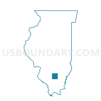
Outline

Summary
| Unique Area Identifier | 571304 |
| Name | CASNER 1 Voting District |
| County | Jefferson County |
| State | Illinois |
| Area (square miles) | 36.02 |
| Land Area (square miles) | 35.98 |
| Water Area (square miles) | 0.04 |
| % of Land Area | 99.90 |
| % of Water Area | 0.10 |
| Latitude of the Internal Point | 38.33998180 |
| Longtitude of the Internal Point | -89.09444360 |
Maps


Graphs
Select a template below for downloading or customizing gragh for CASNER 1 Voting District, Jefferson County, Illinois


Neighbors
Neighoring Voting District (by Name) Neighboring Voting District on the Map
- ASHLEY 1 Voting District, Washington County, IL
- BLISSVILLE Voting District, Jefferson County, IL
- DUBOIS 2 Voting District, Washington County, IL
- GRAND PRAIRIE Voting District, Jefferson County, IL
- IRVINGTON 1 Voting District, Washington County, IL
- MCCLELLAN 2 Voting District, Jefferson County, IL
- RICHVIEW Voting District, Washington County, IL
- ROME 2 Voting District, Jefferson County, IL
- SHILOH 1 Voting District, Jefferson County, IL
Top 10 Neighboring County Subdivision (by Population) Neighboring County Subdivision on the Map
- Shiloh township, Jefferson County, IL (6,620)
- Rome township, Jefferson County, IL (1,669)
- Irvington township, Washington County, IL (1,285)
- McClellan township, Jefferson County, IL (1,255)
- Casner township, Jefferson County, IL (1,239)
- Grand Prairie township, Jefferson County, IL (909)
- Ashley township, Washington County, IL (816)
- Du Bois township, Washington County, IL (748)
- Blissville township, Jefferson County, IL (404)
- Richview township, Washington County, IL (343)
Top 10 Neighboring Place (by Population) Neighboring Place on the Map
Top 10 Neighboring Elementary School District (by Population) Neighboring Elementary School District on the Map
- Woodlawn Community Consolidated School District 4, IL (2,769)
- Rome Community Consolidated School District 2, IL (2,757)
- Ashley Community Consolidated School District 15, IL (2,041)
- Grand Prairie Community Consolidated School District 6, IL (885)
- Irvington County Community Unit School District 11, IL (846)
Top 10 Neighboring Secondary School District (by Population) Neighboring Secondary School District on the Map
- Centralia High School District 200, IL (21,619)
- Nashville Community High School District 99, IL (8,925)
- Woodlawn Community High School District 205, IL (3,330)
Top 10 Neighboring State Legislative District Lower Chamber (by Population) Neighboring State Legislative District Lower Chamber on the Map
Top 10 Neighboring State Legislative District Upper Chamber (by Population) Neighboring State Legislative District Upper Chamber on the Map
Top 10 Neighboring 111th Congressional District (by Population) Neighboring 111th Congressional District on the Map
Top 10 Neighboring Census Tract (by Population) Neighboring Census Tract on the Map
- Census Tract 503, Jefferson County, IL (4,389)
- Census Tract 9504, Washington County, IL (4,231)
- Census Tract 501, Jefferson County, IL (4,181)
- Census Tract 9501, Washington County, IL (3,335)