


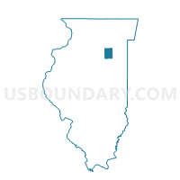
NETTLE CREEK Voting District, Grundy County, Illinois
About
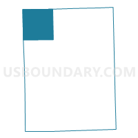
Outline

Summary
| Unique Area Identifier | 571032 |
| Name | NETTLE CREEK Voting District |
| County | Grundy County |
| State | Illinois |
| Area (square miles) | 35.79 |
| Land Area (square miles) | 35.76 |
| Water Area (square miles) | 0.03 |
| % of Land Area | 99.91 |
| % of Water Area | 0.09 |
| Latitude of the Internal Point | 41.41277110 |
| Longtitude of the Internal Point | -88.53830590 |
Maps

Graphs
Select a template below for downloading or customizing gragh for NETTLE CREEK Voting District, Grundy County, Illinois


Neighbors
Neighoring Voting District (by Name) Neighboring Voting District on the Map
- BIG GROVE 2 Voting District, Kendall County, IL
- ERIENNA Voting District, Grundy County, IL
- ERIENNA 2 Voting District, Grundy County, IL
- LISBON Voting District, Kendall County, IL
- MANLIUS 1 Voting District, LaSalle County, IL
- MILLER 1 Voting District, LaSalle County, IL
- MISSION 2 Voting District, LaSalle County, IL
- SARASOTA 5 Voting District, Grundy County, IL
- SARATOGA 4 Voting District, Grundy County, IL
Top 10 Neighboring County Subdivision (by Population) Neighboring County Subdivision on the Map
- Manlius township, LaSalle County, IL (6,275)
- Saratoga township, Grundy County, IL (6,122)
- Mission township, LaSalle County, IL (3,972)
- Erienna township, Grundy County, IL (2,217)
- Big Grove township, Kendall County, IL (1,647)
- Lisbon township, Kendall County, IL (899)
- Miller township, LaSalle County, IL (633)
- Nettle Creek township, Grundy County, IL (503)
Top 10 Neighboring Place (by Population) Neighboring Place on the Map
Top 10 Neighboring Elementary School District (by Population) Neighboring Elementary School District on the Map
- Saratoga Community Consolidated School District 60C, IL (5,979)
- Miller Township Community Consolidated School District, IL (2,337)
- Nettle Creek Community Consolidated School District 24C, IL (929)
- Lisbon Community Consolidated School District 90, IL (883)
Top 10 Neighboring Secondary School District (by Population) Neighboring Secondary School District on the Map
- Morris Community High School District 101, IL (18,332)
- Seneca Township High School District 160, IL (7,164)
- Newark Community High School District 18, IL (3,549)
Top 10 Neighboring State Legislative District Lower Chamber (by Population) Neighboring State Legislative District Lower Chamber on the Map
Top 10 Neighboring State Legislative District Upper Chamber (by Population) Neighboring State Legislative District Upper Chamber on the Map
Top 10 Neighboring 111th Congressional District (by Population) Neighboring 111th Congressional District on the Map
Top 10 Neighboring Census Tract (by Population) Neighboring Census Tract on the Map
- Census Tract 8907, Kendall County, IL (15,257)
- Census Tract 9623, LaSalle County, IL (6,937)
- Census Tract 2, Grundy County, IL (6,648)
- Census Tract 4, Grundy County, IL (5,473)
- Census Tract 9624, LaSalle County, IL (3,983)