


DOUGLAS 7 Voting District, Effingham County, Illinois
About
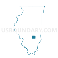
Outline

Summary
| Unique Area Identifier | 570811 |
| Name | DOUGLAS 7 Voting District |
| County | Effingham County |
| State | Illinois |
| Area (square miles) | 3.24 |
| Land Area (square miles) | 3.24 |
| Water Area (square miles) | 0.00 |
| % of Land Area | 100.00 |
| % of Water Area | 0.00 |
| Latitude of the Internal Point | 39.10236600 |
| Longtitude of the Internal Point | -88.55236250 |
Maps


Graphs
Select a template below for downloading or customizing gragh for DOUGLAS 7 Voting District, Effingham County, Illinois


Neighbors
Neighoring Voting District (by Name) Neighboring Voting District on the Map
- DOUGLAS 11 Voting District, Effingham County, IL
- DOUGLAS 12 Voting District, Effingham County, IL
- DOUGLAS 5 Voting District, Effingham County, IL
- DOUGLAS 6 Voting District, Effingham County, IL
- JACKSON Voting District, Effingham County, IL
- SUMMIT 2 Voting District, Effingham County, IL
- TEUTOPOLIS 2 Voting District, Effingham County, IL
- WATSON 3 Voting District, Effingham County, IL
Top 10 Neighboring County Subdivision (by Population) Neighboring County Subdivision on the Map
- Douglas township, Effingham County, IL (12,604)
- Summit township, Effingham County, IL (3,584)
- Watson township, Effingham County, IL (3,193)
- Teutopolis township, Effingham County, IL (2,605)
- Jackson township, Effingham County, IL (1,215)
Top 10 Neighboring Place (by Population) Neighboring Place on the Map
Top 10 Neighboring Unified School District (by Population) Neighboring Unified School District on the Map
- Effingham Community Unit School District 40, IL (20,287)
- Teutopolis Community Unit School District 50, IL (5,674)
Top 10 Neighboring State Legislative District Lower Chamber (by Population) Neighboring State Legislative District Lower Chamber on the Map
- State House District 102, IL (118,987)
- State House District 109, IL (103,405)
- State House District 108, IL (102,103)
Top 10 Neighboring State Legislative District Upper Chamber (by Population) Neighboring State Legislative District Upper Chamber on the Map
- State Senate District 51, IL (220,811)
- State Senate District 55, IL (213,429)
- State Senate District 54, IL (204,199)
Top 10 Neighboring 111th Congressional District (by Population) Neighboring 111th Congressional District on the Map
Top 10 Neighboring Census Tract (by Population) Neighboring Census Tract on the Map
- Census Tract 9506, Effingham County, IL (5,325)
- Census Tract 9505, Effingham County, IL (4,272)
- Census Tract 9508, Effingham County, IL (4,232)