


KING Voting District, Christian County, Illinois
About
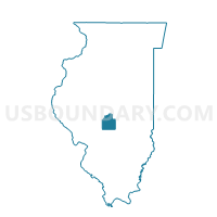
Outline

Summary
| Unique Area Identifier | 564846 |
| Name | KING Voting District |
| County | Christian County |
| State | Illinois |
| Area (square miles) | 36.66 |
| Land Area (square miles) | 36.66 |
| Water Area (square miles) | 0.00 |
| % of Land Area | 100.00 |
| % of Water Area | 0.00 |
| Latitude of the Internal Point | 39.43649620 |
| Longtitude of the Internal Point | -89.50394530 |
Maps


Graphs
Select a template below for downloading or customizing gragh for KING Voting District, Christian County, Illinois


Neighbors
Neighoring Voting District (by Name) Neighboring Voting District on the Map
- BEAR CREEK Voting District, Christian County, IL
- BOIS D'ARC 1 Voting District, Montgomery County, IL
- HARVEL Voting District, Montgomery County, IL
- PAWNEE 1 Voting District, Sangamon County, IL
- RAYMOND Voting District, Montgomery County, IL
- RICKS 1 Voting District, Christian County, IL
- ROUNTREE Voting District, Montgomery County, IL
- SOUTH FORK 2 Voting District, Christian County, IL
- SOUTH FORK 3 Voting District, Christian County, IL
Top 10 Neighboring County Subdivision (by Population) Neighboring County Subdivision on the Map
- Pawnee township, Sangamon County, IL (3,058)
- South Fork township, Christian County, IL (2,788)
- Ricks township, Christian County, IL (1,223)
- Raymond township, Montgomery County, IL (1,200)
- Bois D'Arc township, Montgomery County, IL (956)
- Bear Creek township, Christian County, IL (499)
- King township, Christian County, IL (244)
- Harvel township, Montgomery County, IL (243)
- Rountree township, Montgomery County, IL (240)
Top 10 Neighboring Place (by Population) Neighboring Place on the Map
Top 10 Neighboring Unified School District (by Population) Neighboring Unified School District on the Map
- Panhandle Community Unit School District 2, IL (3,358)
- Pawnee Community Unit School District 11, IL (3,350)
- Morrisonville Community Unit School District 1, IL (1,898)
Top 10 Neighboring State Legislative District Lower Chamber (by Population) Neighboring State Legislative District Lower Chamber on the Map
Top 10 Neighboring State Legislative District Upper Chamber (by Population) Neighboring State Legislative District Upper Chamber on the Map
Top 10 Neighboring 111th Congressional District (by Population) Neighboring 111th Congressional District on the Map
Top 10 Neighboring Census Tract (by Population) Neighboring Census Tract on the Map
- Census Tract 33, Sangamon County, IL (5,004)
- Census Tract 9590, Christian County, IL (4,650)
- Census Tract 9582, Christian County, IL (3,888)
- Census Tract 9575, Montgomery County, IL (3,273)
- Census Tract 9574, Montgomery County, IL (2,491)