


HARDIN Voting District, Calhoun County, Illinois
About
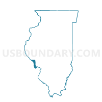
Outline

Summary
| Unique Area Identifier | 564669 |
| Name | HARDIN Voting District |
| County | Calhoun County |
| State | Illinois |
| Area (square miles) | 24.71 |
| Land Area (square miles) | 23.03 |
| Water Area (square miles) | 1.68 |
| % of Land Area | 93.21 |
| % of Water Area | 6.79 |
| Latitude of the Internal Point | 39.15025810 |
| Longtitude of the Internal Point | -90.62699800 |
Maps


Graphs
Select a template below for downloading or customizing gragh for HARDIN Voting District, Calhoun County, Illinois


Neighbors
Neighoring Voting District (by Name) Neighboring Voting District on the Map
- CRATER Voting District, Calhoun County, IL
- GILEAD Voting District, Calhoun County, IL
- HAMBURG Voting District, Calhoun County, IL
- RICHWOOD Voting District, Jersey County, IL
- RICHWOODS Voting District, Calhoun County, IL
- ROSEDALE Voting District, Jersey County, IL
- WOODVILLE Voting District, Greene County, IL
Top 10 Neighboring County Subdivision (by Population) Neighboring County Subdivision on the Map
- Hardin precinct, Calhoun County, IL (1,330)
- Richwood precinct, Calhoun County, IL (844)
- Richwood township, Jersey County, IL (653)
- Hamburg precinct, Calhoun County, IL (561)
- Crater precinct, Calhoun County, IL (525)
- Rosedale township, Jersey County, IL (456)
- Gilead precinct, Calhoun County, IL (342)
- Woodville township, Greene County, IL (239)
Top 10 Neighboring Place (by Population) Neighboring Place on the Map
Top 10 Neighboring Unified School District (by Population) Neighboring Unified School District on the Map
- Jersey Community Unit School District 100, IL (20,217)
- Carrollton Community Unit School District 1, IL (4,286)
- Calhoun Community Unit School District 40, IL (3,490)
Top 10 Neighboring State Legislative District Lower Chamber (by Population) Neighboring State Legislative District Lower Chamber on the Map
Top 10 Neighboring State Legislative District Upper Chamber (by Population) Neighboring State Legislative District Upper Chamber on the Map
Top 10 Neighboring 111th Congressional District (by Population) Neighboring 111th Congressional District on the Map
Top 10 Neighboring Census Tract (by Population) Neighboring Census Tract on the Map
- Census Tract 9512, Calhoun County, IL (2,681)
- Census Tract 9513, Calhoun County, IL (2,408)
- Census Tract 104.02, Jersey County, IL (2,172)
- Census Tract 9738, Greene County, IL (2,134)
- Census Tract 105, Jersey County, IL (1,633)