


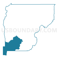
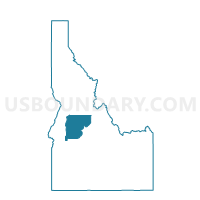
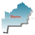
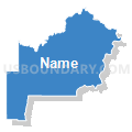
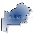
Alpha Voting District, Valley County, Idaho
About
Outline

Summary
| Unique Area Identifier | 564437 |
| Name | Alpha Voting District |
| County | Valley County |
| State | Idaho |
| Area (square miles) | 393.32 |
| Land Area (square miles) | 391.70 |
| Water Area (square miles) | 1.62 |
| % of Land Area | 99.59 |
| % of Water Area | 0.41 |
| Latitude of the Internal Point | 44.39213440 |
| Longtitude of the Internal Point | -115.88096420 |
Maps

Graphs
Select a template below for downloading or customizing gragh for Alpha Voting District, Valley County, Idaho


Neighbors
Neighoring Voting District (by Name) Neighboring Voting District on the Map
- Garden Valley Voting District, Boise County, ID
- Horseshoe Bend Voting District, Boise County, ID
- Ola Voting District, Gem County, ID
- West Mountain Voting District, Valley County, ID
- Yellow Pine Voting District, Valley County, ID
Top 10 Neighboring County Subdivision (by Population) Neighboring County Subdivision on the Map
- Cascade CCD, Valley County, ID (2,586)
- Horseshoe Bend CCD, Boise County, ID (1,928)
- Garden Valley CCD, Boise County, ID (1,863)
- Sweet CCD, Gem County, ID (1,303)
Top 10 Neighboring Place (by Population) Neighboring Place on the Map
Top 10 Neighboring Unified School District (by Population) Neighboring Unified School District on the Map
- Emmett Independent School District 221, ID (16,719)
- Cascade School District 422, ID (2,410)
- Garden Valley School District 71, ID (1,961)
Top 10 Neighboring State Legislative District Lower Chamber (by Population) Neighboring State Legislative District Lower Chamber on the Map
- State House District 11, ID (51,062)
- State House District 8, ID (38,711)
- State House District 22, ID (34,066)
Top 10 Neighboring State Legislative District Upper Chamber (by Population) Neighboring State Legislative District Upper Chamber on the Map
- State Senate District 11, ID (51,062)
- State Senate District 8, ID (38,711)
- State Senate District 22, ID (34,066)
Top 10 Neighboring 111th Congressional District (by Population) Neighboring 111th Congressional District on the Map
Top 10 Neighboring Census Tract (by Population) Neighboring Census Tract on the Map
- Census Tract 9502, Boise County, ID (7,028)
- Census Tract 9601, Gem County, ID (4,390)
- Census Tract 9701, Valley County, ID (2,627)