


1571747 - ATTICA Voting District, Jackson County, Georgia
About
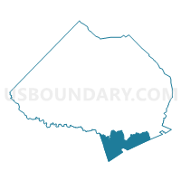
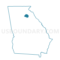
Outline

Summary
| Unique Area Identifier | 562272 |
| Name | 1571747 - ATTICA Voting District |
| County | Jackson County |
| State | Georgia |
| Area (square miles) | 19.02 |
| Land Area (square miles) | 18.81 |
| Water Area (square miles) | 0.22 |
| % of Land Area | 98.87 |
| % of Water Area | 1.13 |
| Latitude of the Internal Point | 34.01297860 |
| Longtitude of the Internal Point | -83.50601750 |
Maps

Graphs
Select a template below for downloading or customizing gragh for 1571747 - ATTICA Voting District, Jackson County, Georgia


Neighbors
Neighoring Voting District (by Name) Neighboring Voting District on the Map
- 01307 - 07 Voting District, Barrow County, GA
- 0595B - WHITEHEAD RD SCHOOL Voting District, Clarke County, GA
- 0595D - ACC FLEET MGT B Voting District, Clarke County, GA
- 0596A - CLEVELAND RD SC Voting District, Clarke County, GA
- 0596B - BOARD OF EDUCATION Voting District, Clarke County, GA
- 1570242 - REDSTONE Voting District, Jackson County, GA
- 1571704 - CENTER Voting District, Jackson County, GA
- 21909 - BOGART Voting District, Oconee County, GA
Top 10 Neighboring County Subdivision (by Population) Neighboring County Subdivision on the Map
- Athens CCD, Clarke County, GA (86,464)
- Jefferson CCD, Jackson County, GA (23,033)
- Bogart CCD, Clarke County, GA (14,721)
- Statham CCD, Barrow County, GA (11,184)
- Bogart CCD, Oconee County, GA (10,590)
- Nicholson CCD, Jackson County, GA (5,494)
Top 10 Neighboring Place (by Population) Neighboring Place on the Map
Top 10 Neighboring Unified School District (by Population) Neighboring Unified School District on the Map
- Clarke County School District, GA (116,714)
- Barrow County School District, GA (69,367)
- Jackson County School District, GA (44,509)
- Oconee County School District, GA (32,808)
Top 10 Neighboring State Legislative District Lower Chamber (by Population) Neighboring State Legislative District Lower Chamber on the Map
- State House District 31, GA (69,009)
- State House District 108, GA (68,282)
- State House District 113, GA (56,617)
- State House District 114, GA (53,145)
- State House District 30, GA (47,974)
Top 10 Neighboring State Legislative District Upper Chamber (by Population) Neighboring State Legislative District Upper Chamber on the Map
Top 10 Neighboring 111th Congressional District (by Population) Neighboring 111th Congressional District on the Map
Top 10 Neighboring Census Tract (by Population) Neighboring Census Tract on the Map
- Census Tract 301, Oconee County, GA (10,590)
- Census Tract 106, Jackson County, GA (8,759)
- Census Tract 1804.02, Barrow County, GA (5,993)
- Census Tract 1304, Clarke County, GA (5,804)
- Census Tract 105, Jackson County, GA (5,494)
- Census Tract 1303, Clarke County, GA (5,402)
- Census Tract 1804.01, Barrow County, GA (5,191)
- Census Tract 1305, Clarke County, GA (2,842)
Top 10 Neighboring 5-Digit ZIP Code Tabulation Area (by Population) Neighboring 5-Digit ZIP Code Tabulation Area on the Map
- 30606, GA (40,225)
- 30549, GA (22,500)
- 30607, GA (10,895)
- 30622, GA (10,344)
- 30666, GA (8,659)
- 30565, GA (4,758)