


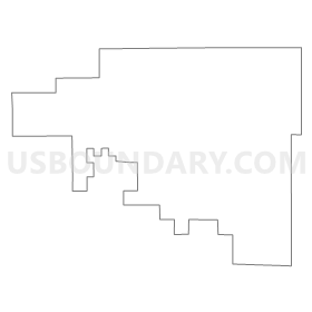
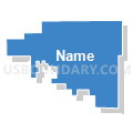
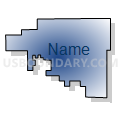
Washington 3, Washington County, Colorado
About
Outline
Summary
| Unique Area Identifier | 549302 |
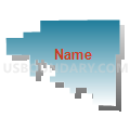
| Name | Washington 3 |
| County | Washington County |
| State | Colorado |
| Area (square miles) | 191.40 |
| Land Area (square miles) | 191.40 |
| Water Area (square miles) | 0.00 |
| % of Land Area | 100.00 |
| % of Water Area | 0.00 |
| Latitude of the Internal Point | 40.35015340 |
| Longtitude of the Internal Point | -102.92811450 |
Maps


Graphs
Select a template below for downloading or customizing gragh for Washington 3, Washington County, Colorado


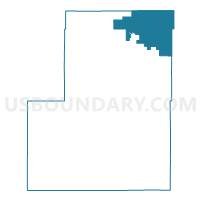
Neighbors
Neighoring Voting District (by Name) Neighboring Voting District on the Map
- Logan 16, Logan County, CO
- Logan 8, Logan County, CO
- Washington 2, Washington County, CO
- Washington 4, Washington County, CO
- Yuma 13, Yuma County, CO
- Yuma 5, Yuma County, CO
Top 10 Neighboring County Subdivision (by Population) Neighboring County Subdivision on the Map
- Yuma CCD, Yuma County, CO (5,004)
- Fleming CCD, Logan County, CO (4,832)
- Akron CCD, Washington County, CO (2,672)
- Otis CCD, Washington County, CO (1,051)
Top 10 Neighboring Unified School District (by Population) Neighboring Unified School District on the Map
- Valley School District RE-1, CO (20,247)
- Yuma School District 1, CO (5,017)
- Akron School District R-1, CO (2,453)
- Haxtun School District RE-2J, CO (1,470)
- Frenchman School District RE-3, CO (953)
- Otis School District R-3, CO (876)
- Lone Star School District 101, CO (255)
Top 10 Neighboring State Legislative District Lower Chamber (by Population) Neighboring State Legislative District Lower Chamber on the Map
Top 10 Neighboring State Legislative District Upper Chamber (by Population) Neighboring State Legislative District Upper Chamber on the Map
Top 10 Neighboring 111th Congressional District (by Population) Neighboring 111th Congressional District on the Map
Top 10 Neighboring Census Tract (by Population) Neighboring Census Tract on the Map
- Census Tract 9632, Yuma County, CO (5,441)
- Census Tract 9664, Logan County, CO (4,832)
- Census Tract 9242, Washington County, CO (2,665)
- Census Tract 9241, Washington County, CO (2,149)
Top 10 Neighboring 5-Digit ZIP Code Tabulation Area (by Population) Neighboring 5-Digit ZIP Code Tabulation Area on the Map
- 80751, CO (18,857)
- 80759, CO (4,698)
- 80720, CO (2,558)
- 80731, CO (1,494)
- 80743, CO (1,074)
- 80728, CO (878)