


Pueblo 17, Pueblo County, Colorado
About
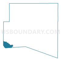
Outline

Summary
| Unique Area Identifier | 549149 |
| Name | Pueblo 17 |
| County | Pueblo County |
| State | Colorado |
| Area (square miles) | 38.12 |
| Land Area (square miles) | 38.08 |
| Water Area (square miles) | 0.04 |
| % of Land Area | 99.90 |
| % of Water Area | 0.10 |
| Latitude of the Internal Point | 37.92868800 |
| Longtitude of the Internal Point | -104.98829430 |
Maps


Graphs
Select a template below for downloading or customizing gragh for Pueblo 17, Pueblo County, Colorado


Neighbors
Neighoring Voting District (by Name) Neighboring Voting District on the Map
- Custer 1, Custer County, CO
- Custer 2, Custer County, CO
- Huerfano 1, Huerfano County, CO
- Huerfano 11, Huerfano County, CO
- Pueblo 81, Pueblo County, CO
Top 10 Neighboring County Subdivision (by Population) Neighboring County Subdivision on the Map
- Colorado City-Rye CCD, Pueblo County, CO (4,658)
- Walsenburg CCD, Huerfano County, CO (4,630)
- Westcliffe CCD, Custer County, CO (4,255)
- Gardner CCD, Huerfano County, CO (538)
Top 10 Neighboring Place (by Population) Neighboring Place on the Map
Top 10 Neighboring Unified School District (by Population) Neighboring Unified School District on the Map
- Pueblo County School District 70, CO (50,231)
- Huerfano School District RE-1, CO (5,403)
- Custer County School District C-1, CO (3,915)
Top 10 Neighboring State Legislative District Lower Chamber (by Population) Neighboring State Legislative District Lower Chamber on the Map
Top 10 Neighboring State Legislative District Upper Chamber (by Population) Neighboring State Legislative District Upper Chamber on the Map
Top 10 Neighboring 111th Congressional District (by Population) Neighboring 111th Congressional District on the Map
Top 10 Neighboring Census Tract (by Population) Neighboring Census Tract on the Map
- Census Tract 28.04, Pueblo County, CO (4,661)
- Census Tract 9701, Custer County, CO (4,255)
- Census Tract 9609, Huerfano County, CO (3,438)