


Pitkin 10, Pitkin County, Colorado
About
Outline

Summary
| Unique Area Identifier | 549066 |
| Name | Pitkin 10 |
| County | Pitkin County |
| State | Colorado |
| Area (square miles) | 228.61 |
| Land Area (square miles) | 228.54 |
| Water Area (square miles) | 0.06 |
| % of Land Area | 99.97 |
| % of Water Area | 0.03 |
| Latitude of the Internal Point | 39.24088570 |
| Longtitude of the Internal Point | -107.31320590 |
Maps

Graphs
Select a template below for downloading or customizing gragh for Pitkin 10, Pitkin County, Colorado


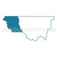
Neighbors
Neighoring Voting District (by Name) Neighboring Voting District on the Map
- Garfield 1, Garfield County, CO
- Garfield 10, Garfield County, CO
- Garfield 13, Garfield County, CO
- Garfield 2, Garfield County, CO
- Gunnison 1, Gunnison County, CO
- Gunnison 2, Gunnison County, CO
- Mesa 82, Mesa County, CO
- Pitkin 8, Pitkin County, CO
- Pitkin 9, Pitkin County, CO
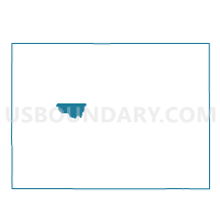
Top 10 Neighboring County Subdivision (by Population) Neighboring County Subdivision on the Map
- Glenwood Springs CCD, Garfield County, CO (25,274)
- New Castle CCD, Garfield County, CO (11,838)
- Snowmass Village CCD, Pitkin County, CO (7,681)
- Collbran CCD, Mesa County, CO (2,490)
- Somerset CCD, Gunnison County, CO (526)
Top 10 Neighboring Place (by Population) Neighboring Place on the Map
Top 10 Neighboring Unified School District (by Population) Neighboring Unified School District on the Map
- Roaring Fork School District RE-1, CO (37,655)
- Delta County School District 50J, CO (31,332)
- Gunnison Watershed School District RE-1J, CO (15,260)
- Plateau Valley School District 50, CO (2,572)
Top 10 Neighboring State Legislative District Lower Chamber (by Population) Neighboring State Legislative District Lower Chamber on the Map
Top 10 Neighboring State Legislative District Upper Chamber (by Population) Neighboring State Legislative District Upper Chamber on the Map
- State Senate District 7, CO (152,044)
- State Senate District 8, CO (148,629)
- State Senate District 5, CO (128,103)
Top 10 Neighboring 111th Congressional District (by Population) Neighboring 111th Congressional District on the Map
Top 10 Neighboring Census Tract (by Population) Neighboring Census Tract on the Map
- Census Tract 1, Pitkin County, CO (7,681)
- Census Tract 9519.01, Garfield County, CO (4,741)
- Census Tract 9518.04, Garfield County, CO (4,202)
- Census Tract 9518.02, Garfield County, CO (3,564)
- Census Tract 18, Mesa County, CO (3,424)
- Census Tract 9639, Gunnison County, CO (905)
Top 10 Neighboring 5-Digit ZIP Code Tabulation Area (by Population) Neighboring 5-Digit ZIP Code Tabulation Area on the Map
- 81601, CO (15,442)
- 81623, CO (15,235)
- 81647, CO (7,104)
- 81621, CO (5,914)
- 81624, CO (1,537)
- 81654, CO (1,391)
- 81434, CO (158)