


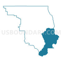
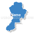
Ouray 1, Ouray County, Colorado
About
Outline

Summary
| Unique Area Identifier | 549032 |
| Name | Ouray 1 |
| County | Ouray County |
| State | Colorado |
| Area (square miles) | 99.36 |
| Land Area (square miles) | 99.30 |
| Water Area (square miles) | 0.05 |
| % of Land Area | 99.95 |
| % of Water Area | 0.05 |
| Latitude of the Internal Point | 38.03052900 |
| Longtitude of the Internal Point | -107.63590250 |
Maps


Graphs
Select a template below for downloading or customizing gragh for Ouray 1, Ouray County, Colorado


Neighbors
Neighoring Voting District (by Name) Neighboring Voting District on the Map
- Hinsdale 1, Hinsdale County, CO
- Ouray 2, Ouray County, CO
- Ouray 5, Ouray County, CO
- San Juan 1, San Juan County, CO
- San Miguel 1, San Miguel County, CO
Top 10 Neighboring County Subdivision (by Population) Neighboring County Subdivision on the Map
- Telluride CCD, San Miguel County, CO (5,865)
- Ouray CCD, Ouray County, CO (4,436)
- Lake City CCD, Hinsdale County, CO (843)
- Silverton CCD, San Juan County, CO (699)
Top 10 Neighboring Place (by Population) Neighboring Place on the Map
Top 10 Neighboring Unified School District (by Population) Neighboring Unified School District on the Map
- Telluride School District R-1, CO (5,867)
- Ridgway School District R-2, CO (2,391)
- Ouray School District R-1, CO (1,694)
- Hinsdale County School District RE-1, CO (813)
- Silverton School District 1, CO (699)
Top 10 Neighboring State Legislative District Lower Chamber (by Population) Neighboring State Legislative District Lower Chamber on the Map
- State House District 61, CO (79,637)
- State House District 58, CO (78,435)
- State House District 59, CO (78,431)
Top 10 Neighboring State Legislative District Upper Chamber (by Population) Neighboring State Legislative District Upper Chamber on the Map
Top 10 Neighboring 111th Congressional District (by Population) Neighboring 111th Congressional District on the Map
Top 10 Neighboring Census Tract (by Population) Neighboring Census Tract on the Map
- Census Tract 9676, Ouray County, CO (4,436)
- Census Tract 9681.01, San Miguel County, CO (2,239)
- Census Tract 9731, Hinsdale County, CO (843)
- Census Tract 9726, San Juan County, CO (699)