


Otero 17, Otero County, Colorado
About
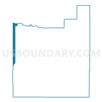
Outline

Summary
| Unique Area Identifier | 549028 |
| Name | Otero 17 |
| County | Otero County |
| State | Colorado |
| Area (square miles) | 19.76 |
| Land Area (square miles) | 19.71 |
| Water Area (square miles) | 0.05 |
| % of Land Area | 99.74 |
| % of Water Area | 0.26 |
| Latitude of the Internal Point | 38.00753080 |
| Longtitude of the Internal Point | -104.04547870 |
Maps


Graphs
Select a template below for downloading or customizing gragh for Otero 17, Otero County, Colorado


Neighbors
Neighoring Voting District (by Name) Neighboring Voting District on the Map
Top 10 Neighboring County Subdivision (by Population) Neighboring County Subdivision on the Map
- Ordway CCD, Crowley County, CO (5,398)
- Fowler CCD, Otero County, CO (1,617)
- Huerfano Valley CCD, Pueblo County, CO (1,027)
- Northeast Pueblo CCD, Pueblo County, CO (714)
- Timpas CCD, Otero County, CO (194)
Top 10 Neighboring Place (by Population) Neighboring Place on the Map
Top 10 Neighboring Unified School District (by Population) Neighboring Unified School District on the Map
Top 10 Neighboring State Legislative District Lower Chamber (by Population) Neighboring State Legislative District Lower Chamber on the Map
- State House District 47, CO (80,602)
- State House District 63, CO (69,709)
- State House District 64, CO (63,179)
Top 10 Neighboring State Legislative District Upper Chamber (by Population) Neighboring State Legislative District Upper Chamber on the Map
Top 10 Neighboring 111th Congressional District (by Population) Neighboring 111th Congressional District on the Map
Top 10 Neighboring Census Tract (by Population) Neighboring Census Tract on the Map
- Census Tract 9696, Crowley County, CO (5,823)
- Census Tract 32, Pueblo County, CO (3,572)
- Census Tract 36, Pueblo County, CO (2,196)
- Census Tract 9680, Otero County, CO (1,617)
- Census Tract 9684, Otero County, CO (1,119)