


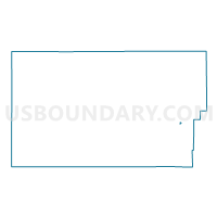
Moffat 12, Moffat County, Colorado
About
Outline

Summary
| Unique Area Identifier | 548954 |
| Name | Moffat 12 |
| County | Moffat County |
| State | Colorado |
| Area (square miles) | 0.18 |
| Land Area (square miles) | 0.18 |
| Water Area (square miles) | 0.00 |
| % of Land Area | 100.00 |
| % of Water Area | 0.00 |
| Latitude of the Internal Point | 40.51845900 |
| Longtitude of the Internal Point | -107.54637710 |
Maps

Graphs
Select a template below for downloading or customizing gragh for Moffat 12, Moffat County, Colorado


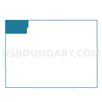
Neighbors
Neighoring Voting District (by Name) Neighboring Voting District on the Map
- Moffat 13, Moffat County, CO
- Moffat 2, Moffat County, CO
- Moffat 3, Moffat County, CO
- Moffat 7, Moffat County, CO
- Moffat 9, Moffat County, CO