


Lincoln 11, Lincoln County, Colorado
About
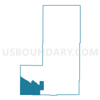
Outline

Summary
| Unique Area Identifier | 548837 |
| Name | Lincoln 11 |
| County | Lincoln County |
| State | Colorado |
| Area (square miles) | 194.71 |
| Land Area (square miles) | 194.38 |
| Water Area (square miles) | 0.34 |
| % of Land Area | 99.83 |
| % of Water Area | 0.17 |
| Latitude of the Internal Point | 38.59002380 |
| Longtitude of the Internal Point | -103.90000510 |
Maps


Graphs
Select a template below for downloading or customizing gragh for Lincoln 11, Lincoln County, Colorado


Neighbors
Neighoring Voting District (by Name) Neighboring Voting District on the Map
- Crowley 1, Crowley County, CO
- Crowley 3, Crowley County, CO
- El Paso 119, El Paso County, CO
- El Paso 82, El Paso County, CO
- Lincoln 10, Lincoln County, CO
- Lincoln 12, Lincoln County, CO
- Lincoln 9, Lincoln County, CO
- Pueblo 85, Pueblo County, CO
Top 10 Neighboring County Subdivision (by Population) Neighboring County Subdivision on the Map
- Southeastern El Paso CCD, El Paso County, CO (12,768)
- Ordway CCD, Crowley County, CO (5,398)
- Northeast Pueblo CCD, Pueblo County, CO (714)
- Karval CCD, Lincoln County, CO (651)
Top 10 Neighboring Unified School District (by Population) Neighboring Unified School District on the Map
- Crowley County School District RE-1-J, CO (5,643)
- Miami-Yoder School District 60-JT, CO (2,196)
- Fowler School District R-4J, CO (2,070)
- Karval School District RE-23, CO (326)
- Edison School District 54-JT, CO (325)
Top 10 Neighboring State Legislative District Lower Chamber (by Population) Neighboring State Legislative District Lower Chamber on the Map
- State House District 19, CO (81,655)
- State House District 47, CO (80,602)
- State House District 63, CO (69,709)
Top 10 Neighboring State Legislative District Upper Chamber (by Population) Neighboring State Legislative District Upper Chamber on the Map
- State Senate District 10, CO (165,884)
- State Senate District 2, CO (125,412)
- State Senate District 1, CO (125,154)
Top 10 Neighboring 111th Congressional District (by Population) Neighboring 111th Congressional District on the Map
- Congressional District 5, CO (725,902)
- Congressional District 4, CO (725,041)
- Congressional District 3, CO (706,186)
Top 10 Neighboring Census Tract (by Population) Neighboring Census Tract on the Map
- Census Tract 9696, Crowley County, CO (5,823)
- Census Tract 46.02, El Paso County, CO (4,289)
- Census Tract 36, Pueblo County, CO (2,196)
- Census Tract 9618, Lincoln County, CO (2,104)
Top 10 Neighboring 5-Digit ZIP Code Tabulation Area (by Population) Neighboring 5-Digit ZIP Code Tabulation Area on the Map
- 81063, CO (2,726)
- 81062, CO (2,439)
- 80864, CO (1,325)
- 81025, CO (1,071)
- 80833, CO (754)
- 80823, CO (203)