


Las Animas 5, Las Animas County, Colorado
About
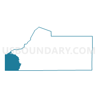
Outline

Summary
| Unique Area Identifier | 548828 |
| Name | Las Animas 5 |
| County | Las Animas County |
| State | Colorado |
| Area (square miles) | 388.70 |
| Land Area (square miles) | 388.41 |
| Water Area (square miles) | 0.29 |
| % of Land Area | 99.93 |
| % of Water Area | 0.07 |
| Latitude of the Internal Point | 37.14898600 |
| Longtitude of the Internal Point | -104.96475280 |
Maps


Graphs
Select a template below for downloading or customizing gragh for Las Animas 5, Las Animas County, Colorado


Neighbors
Neighoring Voting District (by Name) Neighboring Voting District on the Map
- Colfax County Precinct 16, Colfax County, NM
- Colfax County Precinct 2, Colfax County, NM
- Costilla 2, Costilla County, CO
- Costilla 3, Costilla County, CO
- Huerfano 2, Huerfano County, CO
- Las Animas 4, Las Animas County, CO
- Las Animas 6, Las Animas County, CO
- Las Animas 7, Las Animas County, CO
Top 10 Neighboring County Subdivision (by Population) Neighboring County Subdivision on the Map
- Raton CCD, Colfax County, NM (8,062)
- Cimarron CCD, Colfax County, NM (3,475)
- San Luis CCD, Costilla County, CO (1,921)
- La Veta CCD, Huerfano County, CO (1,543)
- Weston CCD, Las Animas County, CO (1,366)
- Aguilar CCD, Las Animas County, CO (1,011)
Top 10 Neighboring Place (by Population) Neighboring Place on the Map
Top 10 Neighboring Unified School District (by Population) Neighboring Unified School District on the Map
- Cimarron Public Schools, NM (3,531)
- Centennial School District R-1, CO (1,890)
- La Veta School District RE-2, CO (1,308)
- Aguilar Reorganized School District 6, CO (1,172)
- Primero Reorganized School District 2, CO (1,153)
Top 10 Neighboring State Legislative District Lower Chamber (by Population) Neighboring State Legislative District Lower Chamber on the Map
- State House District 62, CO (65,723)
- State House District 64, CO (63,179)
- State House District 68, NM (23,727)
Top 10 Neighboring State Legislative District Upper Chamber (by Population) Neighboring State Legislative District Upper Chamber on the Map
- State Senate District 5, CO (128,103)
- State Senate District 2, CO (125,412)
- State Senate District 7, NM (42,634)
Top 10 Neighboring 111th Congressional District (by Population) Neighboring 111th Congressional District on the Map
Top 10 Neighboring Census Tract (by Population) Neighboring Census Tract on the Map
- Census Tract 9507, Colfax County, NM (5,688)
- Census Tract 1, Las Animas County, CO (3,930)
- Census Tract 9506, Colfax County, NM (3,747)
- Census Tract 9609, Huerfano County, CO (3,438)
- Census Tract 3, Las Animas County, CO (2,184)
- Census Tract 9727, Costilla County, CO (1,878)
Top 10 Neighboring 5-Digit ZIP Code Tabulation Area (by Population) Neighboring 5-Digit ZIP Code Tabulation Area on the Map
- 81082, CO (12,480)
- 87740, NM (8,068)
- 81152, CO (1,434)
- 81055, CO (1,339)
- 81020, CO (954)
- 81091, CO (812)